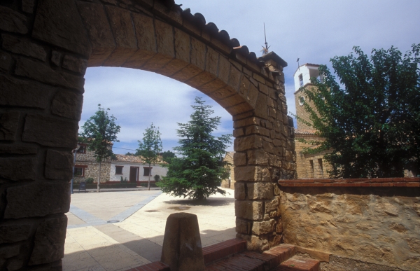
Welcome to Valmuel, a town in the Lower Aragon region and part of the city of Alcañiz. It is located in the valley of the River Regallo, between the left bank of the river and Puigmoreno Hill, on the Valmuel Plain, from which it takes its name. It is 12 kilometres from Alcañiz proper and 4 kilometres from its neighbour Puigmoreno.
Archaeological excavations in the area have discovered remains dating between the Bronze Age and the Iberian and Roman period. After the Christians reconquered the area from the Moors in the 12th century, the area came under the control of the Military Order of Calatrava, whose cross is still to be seen in the doorway of the Masada de la Orden (Farm of the Knights) located near today's Valmuel. After this time, the area became home to mainly farms, most of which were inhabited until the Spanish Civil War.
The village as it is known today was founded in the mid-20th century. In the 1950s the Spanish government's National Colonisation Institute, through its General-Directorate for Devastated Regions, created a series of hydraulic infrastructures to promote agriculture in areas devastated by the civil war. In the case of Lower Aragon, the purpose-built villages of Valmuel and Puigmoreno were planned for the area near to the River Regallo.
The village was first named Alpeñés del Caudillo, later changed to Vamuel del Caudillo, and definitively to Valmuel after the end of Franco's dictatorship (Caudillo being a reference to Franco).
The layout of the village, designed by the architect José Borobio, is based essentially on the priority given to function by the rationalist style. This influenced everything from the location of this purpose-built village, next to the fields, to the design of the houses built for resettlement after the Spanish Civil War, with their clean lines and rear yards, originally meant for keeping animals. This allowed the agricultural aspect as well as the needs of livestock to be covered.
The most important buildings were placed around the central square, the nerve centre, around which the rest of the village was laid out. Among these is the church, with its tall square bell tower, in addition to the fountain, health centre, government building and community centre.
The wide, tree-lined streets of Valmuel welcome visitors to stroll through its charming spaces and hark back to a time when people from different parts of Spain were settled in this village to cultivate its lands.
In their honour, Valmuel opened its Interpretive Centre for Settlers in 2008, in which explanatory panels and a documentary relate who the first settlers were and their personal stories.
ENLACES RECOMENDADOS
Programme Samll but not invisible broadcast on Aragón TV devoted to Valmuel
For more information on the cultural heritage of Valmuel
Welcome to Torrecilla de Alcañiz, a town in the Lower Aragon region. The town lies on the right bank of the River Mezquín, 12 kilometres from Alcañiz.
The burial caves discovered in the areas known as La Cortada II and Balsa Nueva, dating from the Bronze Age, and the finds from the time of the Ancient Iberian civilisation are the earliest evidence of the presence of human activity in the area prior to the the existence of the town we know today.
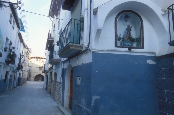
The reconquest of the Lower Aragon region from the Moors was completed in the 12th century under King Alfonso II of Aragon, who handed over control of the lands to the military orders. Torrecilla de Alcañiz was part of the territory that formed the Commandery of Alcañiz, governed by the Military Order of Calatrava. This dependence on Alcañiz would endure until the treaty of 1646 which granted independence to the districts falling under the Alfoz de Alcañiz, the territory administered by the city. It came under the administration of the city of Alcañiz in the 18th century until the division of Spain into provinces in 1833.
The old town was once protected by a wall, of which nothing now remains. The town of Torrecilla has two outstanding monuments, its church and the town hall, in addition to good examples of vernacular architecture. Of interest too are the engineering works associated with the use of water, such as the fountain, dam, irrigation canal and reservoir.
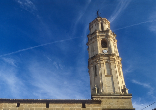
The church is dedicated to Saint Michael the Archangel and was built in two stages. The first took place in the late 16th century, which resulted in the Renaissance-style features of the apse and star-ribbed vaulting, while the second and final stage took place in the 17th century, in the Baroque style. The latter stage is particularly evident in the beautiful tower located at the front of the church, with a combination of elements. The lower section, built in stone, like the rest of the church, is incorporated into the façade, from which three differentiated octagonal sections rise built in brick.
.
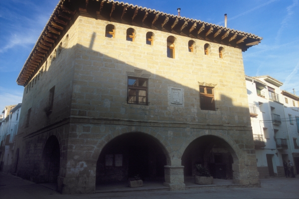
On leaving Plaza de la Iglesia, the square the church faces, by following Calle San Roque we reach Plaza de España, the square that is the location for the magnificent town hall. Built in the late 16th century in the Renaissance style, the town hall is a rectangular, three-storey edifice. The three-sided former market on the ground floor is entered through any of four low arches. The windows on the first floor feature an interesting variation in the carved lintels, with the exception of the side window which is flanked by two pilasters and topped by a pediment. The uppermost floor of the building features a gallery with a typical Aragonese-style arcade cut into the wall, and is crowned by broad cantilevered eaves with brackets.
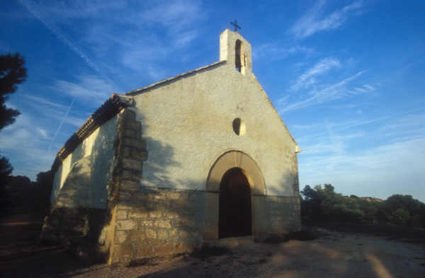
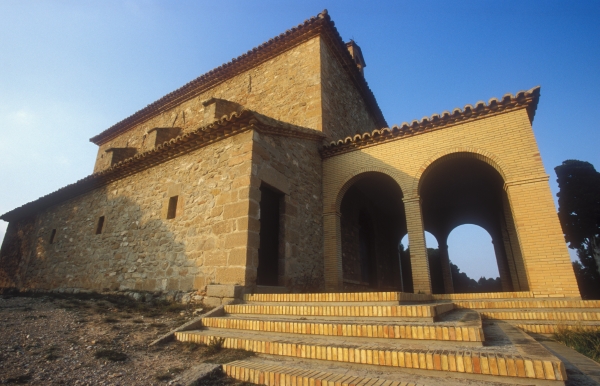
A few kilometres from Torrecilla stands the chapel of Santa Bárbara, built in the 16th century and restored in the 20th century. Its plain plaster-rendered walls have a simple doorway with a semicircular arch and belfry. Built on a hill with magnificent views over the area, it becomes the destination for a procession and a place for the locals to gather on Easter Monday.
On the outskirts of the town, on a hillside, is the Calvario (Mount Calvary procession route), with its characteristic Stations of the Cross. José Pardo Sastrón, a famous botanist and pharmacist who was born in Torrecilla, planted different species of trees and shrubs which visitors can now identify by means of explanatory panels.
Finally there are other interesting examples of cultural heritage, such as the circular stone sheds scattered throughout the surrounding countryside, the old textile mill located by the chapel of Santa Bárbara, the old lime kiln in the area known as El Chinebral and the complex formed by the well and the remains of four olive oil mills, which were once used to produce the renowned Bajo Aragón (Lower Aragon) olive oil.
RECOMMENDED LINKS
20 villages, 20 events. San Blas (the festival of Saint Blaise).
For more information on the cultural heritage of Torrecilla de Alcañiz
Welcome to Los Olmos, a town in Lower Aragon, located in the east of the region. The town lies 44 kilometres from Alcañiz on a spur of the Iberian Mountain Range at an altitude of 806 metres.
Its name is derived from olmo, or elm tree in reference to their abundance in the area, an example of which is the row of these trees that line the entrance to the municipality. Evidence of the earliest settlers in the area can be found at the Mas del Hambre archaeological site where remnants of the Ancient Iberian civilisation have been found. Interesting traces of the Imperial Age of Rome have also been found at the La Regadía site.
Los Olmos was a part of the land donated by King Alfonso II of Aragon to the Military Order of Calatrava after the area was reconquered by the Christians from the Moors in the 12th century. It may have taken some time to be repopulated given that it is not included in the list of hamlets of the Alfoz de Alcañiz, territories administered by this city, in the 1263 census. It was under the administration of the city of Alcañiz in the 18th century until the division of Spain into provinces in 1833.
The oldest part of the town is the highest part, in the vicinity of Calle Rosario, around the no longer existent castle. This was the site of the old church of Santa Ana and its cemetery, which led to the current name of this neighbourhood, Santana.
In the late 16th century, the town spread onto the flat land, where the new church and town hall were built.
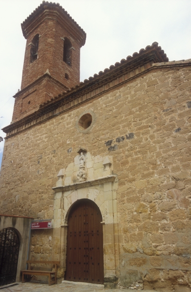
The church of El Salvador was completed in 1698 and features austere and simple decoration, which was created in the year indicated over the front door, 1703. It is a beautiful Baroque-style church, built in stone, with a classical-style tower in brick and projecting eaves. In the lower part of the tower is the communal bread oven known as "pan cozer".
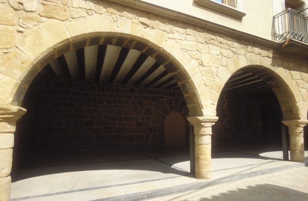
The most outstanding piece of public architecture in Los Olmos is its town hall, the lower level of which housed the old market, built in stone with semicircular arches supported by columns. From here access can be gained to the town hall and municipal oven, now restored.
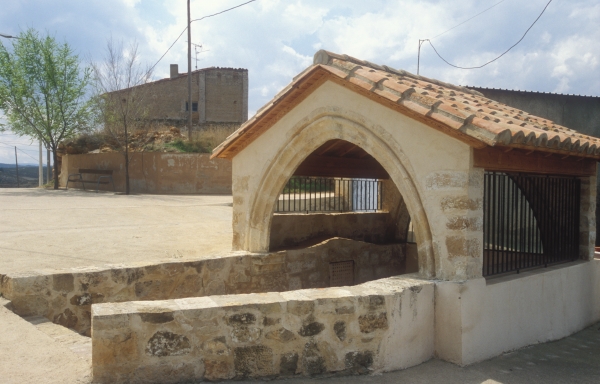
The town contains a number of interesting mansions, and the Fountain of Valdivieso, protected by a structure with an arched opening and pitched roof, which also contains a bench where the inhabitants of the town can enjoy the benefits of the mineral and medicinal waters.
One kilometre from the town and standing on a hill is the chapel of Santa Bárbara, devoted to Saint Barbara, patron saint of miners, which once featured a Mount Calvary procession route or Stations of the Cross, of which little remains. From this privileged location the entire town of Los Olmos and its beautiful surroundings can be contemplated. Finally, on the outskirts of Los Olmos are other examples of its vernacular architectural heritage, the remains of an old ice house and of the old wash house.
The local folk dance known as La Guirnalda (the Garland) has recently been rescued and is performed in August by all of the residents of the town.
RECOMMENDED LINKS
To watch the programme Small but not invisible broadcast on Aragón TV devoted to Los Olmos
For more information on the cultural heritage of Los Olmos.

Welcome to Las Parras de Castellote, a town in the Lower Aragon region located between the Rivers Guadalope and Bergantes, 46 kilometres from Alcañiz. The municipal district includes the two towns of Las Parras de Castellote and Jaganta
Its name refers to its association with Castellote and the presence of parras or vines in the area.
Archaeological excavations in the area evidence the presence of the settlement since the early Iron Age, at the Cabezo de los Canales site, and more particularly from the Ancient Iberian period at El Pilón de San Pablo and El Casejo del Tío Anico sites.
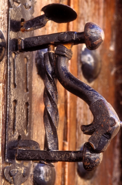
As occurred with the other localities in the area, Las Parras de Castellote was part of the lands reconquered by King Alfonso II of Aragon from the Moors in the 12th century, and was administered first by the Knights Templar and later by the Knights Hospitaller as part of the Commandery of Castellote. In 1612, the town began the process of gaining autonomy from Castellote, and after 1711 was administered by Alcañiz until 1833, when Spain was divided into provinces.
There is a wealth of cultural heritage in Las Parras, a living testament to the history of the town and its inhabitants. The most outstanding of all its buildings is the church of San Nicolás de Bari, built in masonry in the 17th century. Laid out on a rectangular plan, it has a squared-off apse, side chapels and a barrel vault ceiling with lunettes. Of great interest is the Mannerist-style stuccowork that is used to embellish the vault and arch intradoses. At the front of the church, integrated into the façade on the left (gospel) side of the doorway is the square bell tower with a pyramidal spire.
On the side of the church, adjacent to the apse, is the Gate of San Antón, which was once part of the town's defensive wall. It is in the Baroque style and crowned with a classical-style open niche-chapel that houses the image of Saint Anthony the Great, after whom it is named.
In Calle San Antón and Calle Mayor are beautiful and noble houses with arched doorways that still preserve inscriptions on their façades dating from the 17th and 18th centuries. Examples are Casa Escuder, with an upper arcade and cantilevered wooden eaves, and the town hall, with the old market on the ground floor, demarcated by semicircular arches supported by columns.
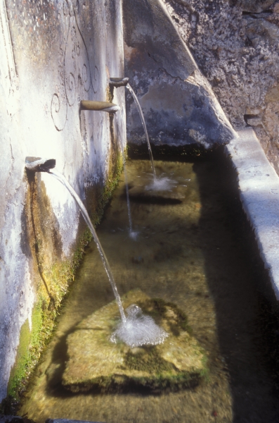
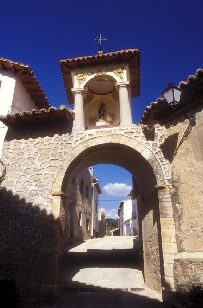
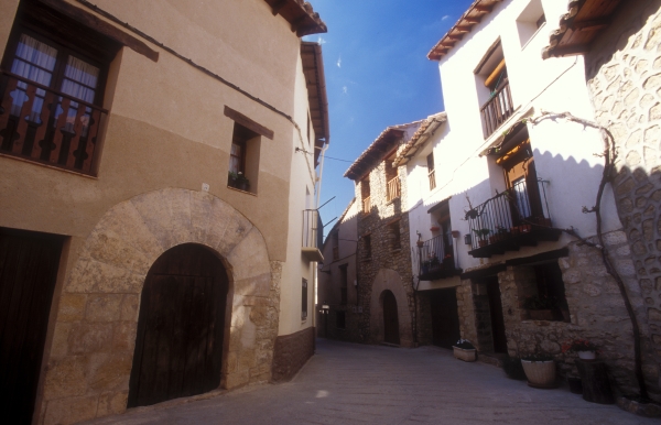
But the streets of Las Parras are home to many more interesting examples of vernacular architecture and engineering. This is the case of the bridge near the church comprising stone arches, the magnificent traditional wash house, the treadmill operated by animal traction, recently restored, the Upper and Lower Fountains, and the old mills, which once produced olive oil and flour, the latter now converted into a care home for the elderly.
Finally, a walk around the outskirts of the town will lead to the chapel of Santa María Magdalena, known popularly as "La Malena", and the chapel of El Calvario or Monte Santo (Holy Hill), which offers an excellent vantage point over the area.
RECOMMENDED LINKS
To watch the programme Small but not invisible boadcast on AragónTV devoted to Las Parras de Castellote
For more information on the cultural heritage of Las Parras de Castellote
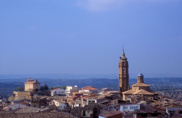
Welcome to Valdealgorfa, a town that stands on a promontory in the Lower Aragon region, 16 kilometres from Alcañiz.
There are several theories on the origin of the name Valdealgorfa. It has been related to the Arabic term al gurfa, which means the space under the roof where grain is stored, and would be in reference to the abundance of grain in a valley (val). Other sources date the name from the Iberian or Pre-Roman period, with the meaning of “valley of the spring”.
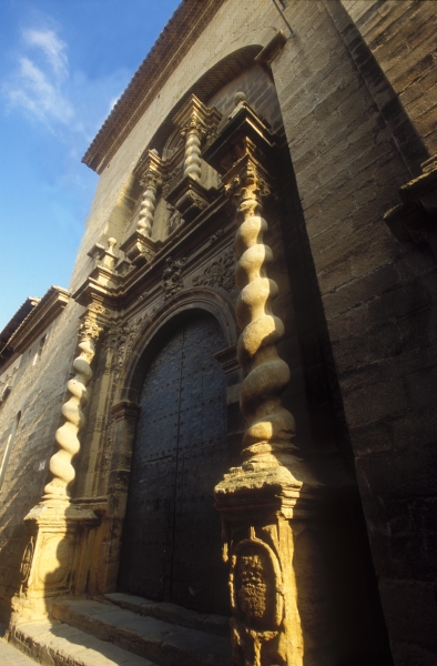
The earliest evidence of human existence in the area is represented by the rock paintings found in Val del Charco del Agua Amarga, a location in the municipal area of Alcañiz but traditionally linked with the inhabitants of Valdealgorfa. Interesting archaeological sites have been discovered dating from the Ancient Iberians such as that of Cabezo del Ariño, in the district of Las Talayas.
After their reconquest by the Christians from the Moors in the 12th century, King Alfonso II of Aragon donated these lands to the Military Order of Calatrava. Valdealgora belonged to the Alfoz de Alcañiz, territory administered by this city, but although it was under the control of the Commandery of Alcañiz, municipal power was held by the Confraternity of Saint Martin and Saint Mary Magdalene, which fought for the town's autonomy. This came in 1624, and was ratified in 1629 by King Philip IV of Spain in a treaty.
A stroll through the streets of Valdealgorfa is soon rewarded by a display of the town's rich architectural heritage. In its day, the town was walled, with access provided via a series of gates. Still visible today are the Alcañiz Gate and the San Roque Gate, the later with a niche-chapel over it dedicated to its namesake Saint Roch.
The recently restored tower of the parish church, is the most emblematic image of the church building dedicated to The Birth of Our Lady, which was built in 1703 in masonry and ashlar in the Baroque style. It features a nave and two aisles covered with a barrel vault, lunettes and groin vaults, respectively. The façade, which mimics an altarpiece, is flanked by Solomonic columns. And the large brick tower is comprised of differentiated sections reminiscent of the Mudéjar style.
In close proximity to the church is the town hall, which was built in 1601 on the site of the former headquarters of the Confraternity of Saint Martin and Saint Mary Magdalene. The three-storey building in masonry and ashlar has an arched doorway and an upper gallery with a typical Aragonese-style arcade under cantilevered eaves of more modern construction that replicates the original.
Continuing on the tour of the town allows you to walk amid noble Renaissance-style mansions with arched stone doorways, such as the house of the renowned botanist Pardo Sastrón and that known as Casa Mora. But standing out above all others is the palatial home of the Baron de Andilla, located in the Plaza de Mercado, the popular market square. Built in the late 16th and early 17th centuries, it has a style similar to that of Aragonese Renaissance palaces, with the typical upper gallery styled as a loggia – with low arches between columns – under large cantilevered wooden eaves.
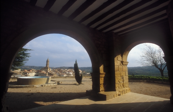
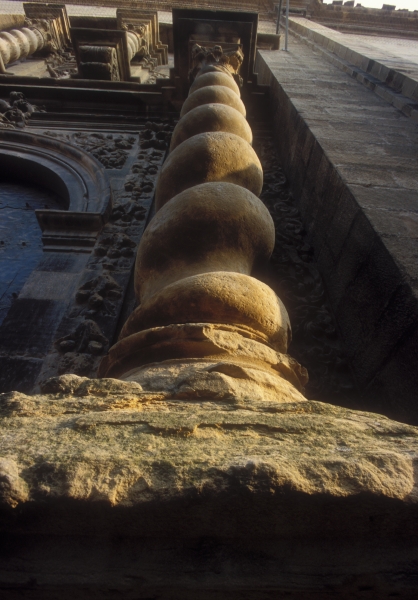
Examples of the town's religious heritage that are worthy of a visit are the chapel of El Buen Suceso, dating from the 18th century but rebuilt in the 19th century after being razed by a fire lit by French troops , the chapel of Santa Bárbara, whose setting is a privileged vantage point close to the main road, and the Convent of Santa Clara, located at the entrance to the town.
Finally, examples of vernacular architecture and engineering include the old olive oil mill, the restored textile mill, the Palomar Tower and hydraulic works: the chain-operated well, the Balsa de los Balcones reservoir, the Collao reservoir, and the old cold vault that is included in the local Route of the Ice Houses and Cold Vaults.
The cold vault is striking because of its floor, which features drainage channels carved into the stone. The lighting specially designed for this structure highlights those channels with cold light, while the stone masonry walls are bathed in blue light, creating the effect of cold that is in keeping with that found along the Route of the Ice Houses and Cold Vaults. A dramatised recording explains the systems used to operate the cold vault in the 17th century and gives insight into its workings.
Finally, the old railway station, is the starting point for the Val de Zafán Trail, that follows the old route of the railway line that reaches Tortosa after crossing the scenic landscapes of the neighbouring Matarraña and Terra Alta regions. In close proximity to this station is the Equinox Tunnel, so-called because the sun shines through its two-kilometre route from end to end twice a year, coinciding with the equinoxes.
RECOMMENDED LINKS
20 villages, 20 events Feria de la Almendra (Almond Festival)
Fore more information on the cultural heritage of Valdealgorfa
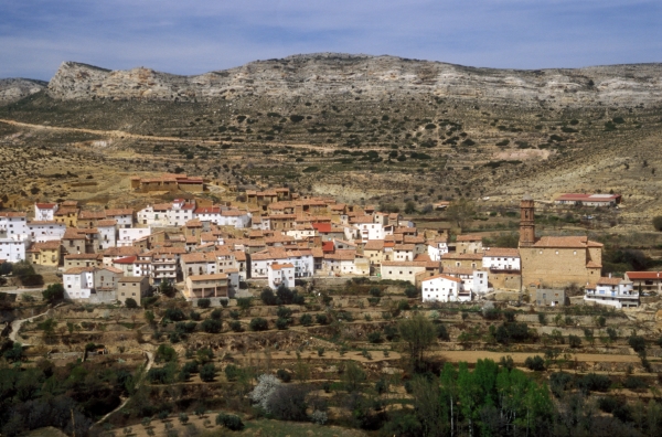
Welcome to Seno, a town in the Lower Aragon region, located in the Guadalopillo Valley, on the boundary with the Maestrazgo region, 44 kilometres from Alcañiz.
The large number of archaeological sites existing in the municipality retrace the steps of the area's earliest inhabitants, spanning the Neolithic, Bronze and Iron Ages. Of importance are the traces of the mining and metallurgic production of the Ancient Iberians in addition to the ruins of a Roman Villa in the area known as Fuente de Salz. That was most likely the period from which the name of the town originated, in reference to the anthroponym Senus, possibly the owner of an ancient fundus or estate.
The first written records that show the existence of the town we know today date from the 12th century, in the charter of privileges granted to the town of Camarón to enable its settlement after the land was reconquered by the Christians from the Moors under King Alfonso II of Aragon, who donated the land to the Knights Templar, and later to the Knights Hospitaller, as part of the Commandery of Castellote. Documentation from both military orders refer to Seno as a castellar, which means that the first building or origin of the town was a defensive tower, most likely a Templar fortress.
The town's dependence on Castellote gave rise to a long conflict, which ended with the signing by King Charles II of a privilege of separation in 1674, although it did not take effect until 1789, more than a century later, when King Charles V granted Seno its town charter.
The town proper is built on the spur of a hill, like an amphitheatre, dominating the entire valley, known as El Arroyo de Seno.
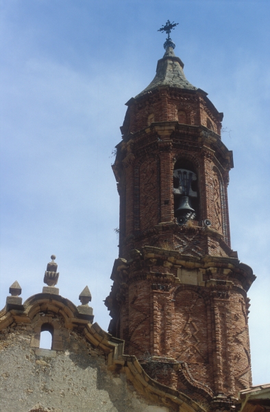
Dominating the town's architectural splendour is the church of Santa Elena, built on the site of the former church of Santa Cruz. Construction of the church was led by master builder Juan Espada in the late-Baroque style although with some features of the incipient Neoclassical style. The inscription on the façade of the church, “Charitas me fecit. 1763-1771”, indicates when it was built. It has a rectangular layout, with a nave and two aisles of similar height divided by piers of double columns, showing the influence of the Basilica of Our Lady of the Pillar in Zaragoza (Saragossa) and the collegiate church in Alcañiz. The tower, located at the front of the church, is reminiscent of the Mudéjar style, as seen in its decorative brickwork and the two differentiated sections, one square and the other octagonal. The bell, dating from the 18th century, has recently been restored. Of interest are the paintings in the sanctuary, which depict the eight women of the Old Testament and Saint Helen, for whom the church is named, while the Holy Spirit is represented inside the dome.
In the same square, next to the church, is the town hall. This is a two-storey building whose ground floor formerly housed the market, defined by two semicircular arches, also traditionally used as a pelota court.
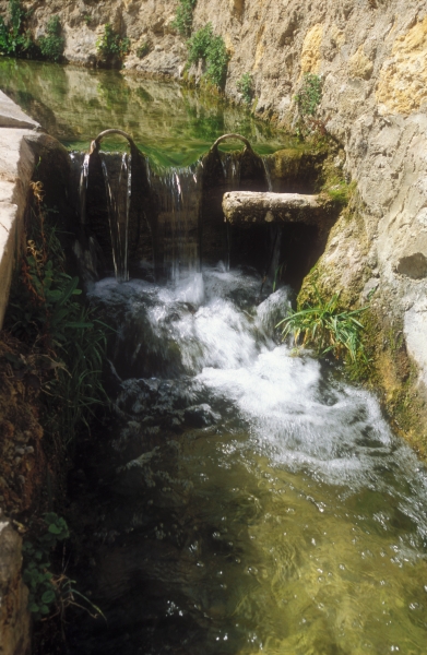
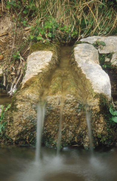
Outside of the town is the chapel of San Valero, in honour of Saint Valerius, the town's patron saint. It was built in 1700 in the Baroque style. A number of cypress trees remain of what was once the town's Stations of the Cross. Next to the chapel is the Well of the Saint, a spring whose waters emerge at 15ºC all year, and which are known to have medicinal properties. According to legend, Saint Valerius visited this place on his way into exile; and because there was no water here, he struck the ground with his rod and brought forth the spring. The spring feeds the channel known as Salién, the wash house located behind the town hall and the old flour mill.
(To see and hear Seno's newly restored bell chiming, click here)
In the area surrounding Seno, although within the municipal area of Castellote, is the landscape known as Paraje de los Fantasmas ("Place of the Ghosts"), a set of red volcanic hills of great beauty, whose name comes from local legend. It is said that on moonlit nights, the mountains resemble a group of monks of ghostly appearance. Click on this link to locate them on a map and for a picture.
RECOMMENDED LINKS
20 villages, 20 events Procession to La Virgen de la Peña.
For more information about Seno.
For more information on the cultural heritage of Seno
Welcome to Mas de las Matas, a town in the Lower Aragon region, located on the banks of the River Guadalope, 34 kilometres from Alcañiz.
Its name is derived from the mas (farmstead) that belonged to the Mata Family. Records show the existence of a farmstead belonging to two brothers named Mateu and Jayme La Mata in 1460 on the site now occupied by the town.
Many archaeological sites have been excavated in the municipality, which have allowed a clear picture to be formed of the timeline in which different settlers came to the area between the Palaeolithic Period and the Middle Ages.
 The origin of the town we know today is the settlement of Kamarón (also written Camarón), which was located on the Santa Flora Hill. It received this name in the Middle Ages, but it existed throughout Iberian, Roman and Moorish times. The castle at Kamarón was captured from the Moors in the 12th century by the Christians under King Alfonso II of Aragon and became part of the Commandery of Castellote, which was administered by the Knights Templar and later by the Knights Hopsitaller.
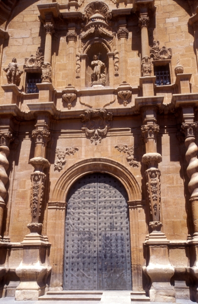
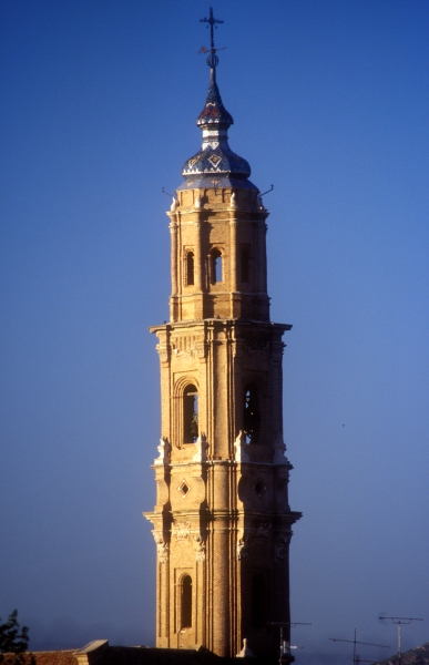
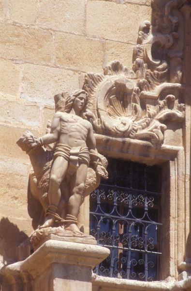
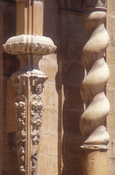
Mas de las Matas was not considered a town until the 16th century and depended on La Ginebrosa until it gained its autonomy through a treaty in 1611. Two other events of importance took place in the town. The first was when General Espartero set up his headquarters in the the town in 1839 during the First Carlist War. The second was the revolutionary experience of collectivisation implemented by the anarchists in the Lower Aragon region during the Spanish Civil War. At its peak, during the 18th century, the most emblematic edifice was built in the town, the church of La Degollación de San Juan Bautista. This Baroque-style church has a nave, with a barrel vault, and two aisles of equal height, covered by groin vaults, with a dome at the crossing. The decoration inside the church is simple as a result of the rebuilding work carried out after it was burnt during the civil war. The magnificent doorway, flanked by Solomonic columns, and its grandiose tower built of brick and rising over sixty-four metres in height, complete the description of this beautiful church. The town's religious heritage is completed by its chapel of Santa Flora, dating from the early 18th century, where a vantage point offering magnificent views has recently been created. It can be accessed via the Calvario (Mount Calvary procession route). Unfortunately, the chapel of Santa Bárbara is in ruins.
The town of Mas de las Matas is home to buildings of great interest, such as the town hall, dating from the mid-17th century, above the space that housed the old market, built in stone with semicircular arches on the ground floor, and a long balcony running along the upper storey. Also worthy of mention are Casa Zárate, originally the house of Father Diego Sanz, built in the 17th century, and Casa Feliú, dating from the 18th century. The latter houses the Mas de las Matas Museum, a branch of Dinópolis, created by the Grupo de Estudios Masinos, where collections of archaeology and fine arts are exhibited.
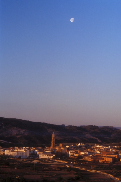
Finally, mention should also be made of the examples of hydraulic engineering in the town, which started with the irrigation system built by the Moors in the 8th century that crosses the town. The Acequia Mayor, an important water channel, was built in the 18th century to feed the numerous wash houses found in the streets of the town, such as the Las Lunas and El Brazal wash houses. The flour mill, now restored, is a must for visitors to Mas de las Matas, and is an example of the transition from traditional to industrial milling systems.
Ever since 2004, for two days, Mas de las Matas returns to its 17th or 18th-century past, depending on the period chosen to be recreated, studied and discovered. Hence, in 2004, 2005, 2006 and 2007, it was the 17th century, and in the first three editions 1661 was chosen as it was the moment when Commander Ramón de Perellós y Rocafull took possession of the town. He would later rise to become the Grand Master of the Order of Malta (Knights Hospitaller) in 1697. In 2008 and 2009, the commander chosen for the recreation was Silverio Dolz y Español, who took control of this commandery in 1707. In the 18th century, with the Bourbons on the Spanish throne, it was Manuel de Sada y Antillón who took possession of the commandery in 1732 who governed until his death 32 years later. This commander achieved positions of great importance throughout his life, but it was also a period of great importance for our town, owing to what our ancestors managed to achieve, such as building the church, the flour mill, a new ratification of the treaty of autonomy, etc. events that were not free from tension and conflict with the commander himself.
The theme of the recreation, which is based on documented historical events, changes from one year to another. Depictions have been made of the taking of possession, or the silk dispute. In 2011 the commemoration deals with the 400th anniversary of the signing of the treaty between La Ginebrosa, Aguaviva and Mas de las Matas, culminating a year of activities shared by the three towns. The dramatisation of the signing was interpreted by actors from the three localities, having already been performed in La Ginebrosa and Aguaviva at a date close to the actual date of signing in 1611, 16–17 August.
The festival has been evolving year after year, with the intention of introducing acts or activities that are appealing, educational and respectful with the time that is to be recreated. There have been workshops on the calligraphy of the period, minting, flag bearer and falconry shows, exhibitions on the militias, etc.
The music and songs of those centuries has been given pride of place since the very beginning. Every year the cultural activity of the Return of the Commander Weekend begins with a recital of songs or music from the period in the church on the Friday night, and the High Mass on Sunday has always been sung, with a repertoire of sacred music that is continuously being renewed. In 2010 a new milestone was reached with the première of a commemorative mass especially dedicated to the event. The Mass of the Commander, was composed by Father Jesús Marúia Muneta, recorded for the edition by the Polifónica Alcañizana choir, conducted by Jesús Ponz. Both the market and the dinner in honour of the commander with all participants dressed in period costume are accompanied by music of the period, pre-recorded or live, and folk music is guaranteed by the presence of the local group Dulzaineros El Relicario.
A Market from the Golden Age with stalls selling traditional crafts, show taverns, exhibition of old farm equipment, and the recreation by residents of farming scenes or scenes from everyday life, traditional soap-making, washing with ashes, together with different street performers. There has been no year without gatherings of giants and bagpipes, on exchanges with the local group La Pasma, fencing masters from the Asociación Española de Esgrima Antigua, who have been faithful to the event since its inception, and horses from equestrian associations from Alcorisa and Alcañiz. These and other activities that recreate the period serve to reinforce the celebration of an event that recreated the arrival of a new commander, which for their contemporaries was imbued with respect and admiration, and already at the time with a hint of conflict, which is currently recreated by the blind man with his critical and satirical romances as he wanders around the town all weekend. Download 2015 programme
More information about the town:
RECOMMENDED LINKS
For more information on the cultural heritage of Mas de las Matas
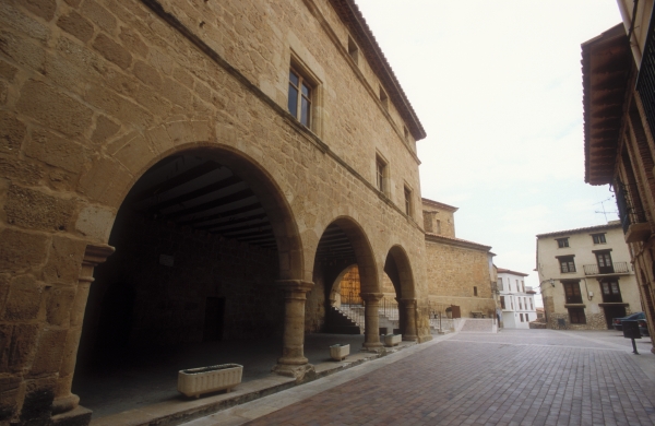
Outstanding among this locality's monumental examples of cultural heritage is the complex formed by itschurchandtown hall. The church is dedicated to Saint Bartholomew. Building commenced in the late 16th or early 17th century and replaced an earlier church. The town hall stands at a right angle to the church. It was built in quality stone at the end of the 16th century. The lower floor is occupied by the characteristic space formerly occupied by the market and used as a pelota court, and the old jail.
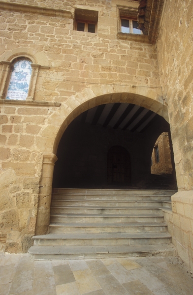
The locality also has several examples of private homes of architectural interest. These houses are markedly vernacular in style and have very unique features: upper arcades in brick, carved window sills and large arched doorways, often emblazoned with the family coat of arms. The inscriptions that are still preserved refer to the date of construction, mainly the 17th century. Most of these are found in Calle Mayor and Calle Baja.
Inside the town are two chapels: the chapel of LaVirgen de Gracia(the current building dates from the 17th century over an earlier one, keeping the original appearance) and the chapel ofEl Rosario, with a round design dating from the late 18th century.
On the outskirts of the town are thechapel of El Dulce Nombre de Jesús, also known as the "dulce (sweet) chapel"; thechapel of San Cristóbal; and theold ice house, which was recently restored and is the starting point for the Route of the Ice Houses and Cold Vaults.
Located at the highest point of the town, next to the threshing floors, this ice house is differentiated by its spectacular ashlar domed roof and five exterior openings made to allow it to be filled with and emptied of snow.
The ice houseis accessed through the adjacent building that serves as an interpretive centre for the route. See technical specifications
The annexe is built on the former clearing space of the ice house, and it offers information on the location of other ice houses and cold vaults, a model of how the interior worked and an audiovisual presentation about the transport of fish from the coast using ice houses to restock the ice used to preserve the fish.
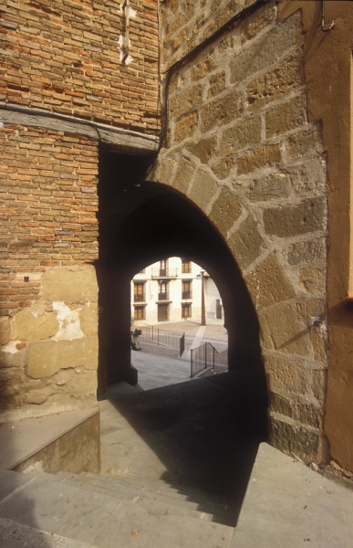
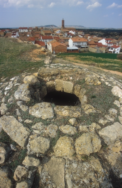

Lighting and ambient sound complete a pleasant and surprising visit to this ice house.
To visit the ice house: Local Council Tel.:+34 978 849 154
ENLACES RECOMENDADOS
For More Information on the cultural heritage of La Mata de los Olmos
Scenic and Environmenal Catalogue
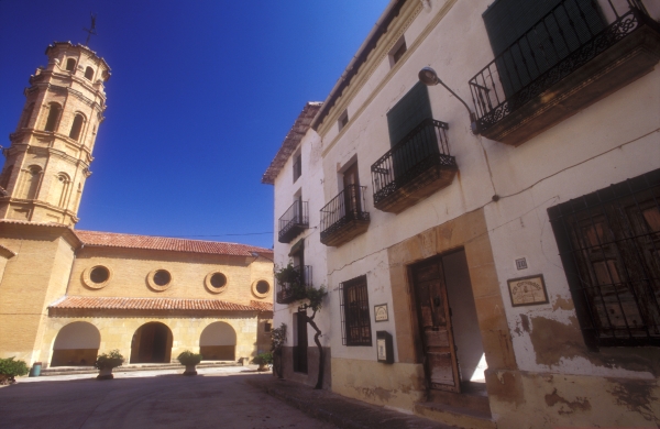
Welcome to Torrevelilla, a municipality in the Lower Aragon region. The town is located between the Rivers Mezquín and Guadalope, 19 kilometres from Alcañiz.
Its name probably refers to the existence of defensive tower or farmhouse (both of which are referred to as torre in Aragon), belonging to the Velilla family, around which a settlement developed.
Like the other towns and villages of the Lower Aragon region, Torrevelilla became a part of the Commandery of Alcañiz after the Christians reconquered the land from the Moors and their donation to the Military Order of Calatrava by King Alfonso II of Aragon in the 12th century. It would depend directly on Castelserás, from which it would not gain its independence until the 18th century when King Charles III of Spain granted the locality its town charter. It would come under the administration of the city of Alcañiz until the division of Spain into provinces in 1833.
Torrevelilla suffered greatly from the consequences of war, particularly the Spanish Civil War, which left eighty per cent of the town proper in ruins. It was mostly rebuilt in the 1950s, which brought about great changes to the townscape.
Among the most striking buildings in the town are thechurchand thetown hall.The town's church is dedicated to Saint Quiteria and was built by the Spanish government's General-Directorate for Devastated Regions en 1953. The church was built in brick in the Neo-Mudéjar style and features a largetower, which combines a square base with another three octagonal sections, and porches on the front and on the right (epistle) side of the church.
The town hall is located in Plaza de España, the square formerly called Plaza Mayor. The building dates from the 17th century, and although it underwent later remodelling, it retains its original architectural style, part of its walls and the old pelota court. It is laid out over three levels, with a ground floor occupied by the old market and pelota court, with an upper gallery featuring typical Aragonese-style arcade and cantilevered eaves. The coat of arms carved in sandstone above the main balcony dates from its earlier construction. It was listed as a monument of local interest in 2004.
A stroll through Torrevelilla offers visitors a glimpse of good examples of vernacular architecture in its whitewashed buildings and wrought iron balconies. In one of these buildings, very close to the town hall is the niche-chapel dedicated to Saint Roch. Other important buildings are the house known as Casa Ruiz and Casa de Conrado Vallés.
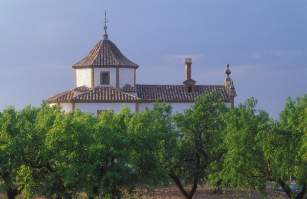
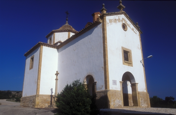
The town's religious heritage is completed by thechapel of San Joaquín, in the Baroque style, which features a dome decorated on the inside with sculptures of the four evangelists, and a boundary cross dating from the 14th century in the vicinity of the chapel. Of interest is the Calvario (Mount Calvary procession route), rebuilt in the 1960s, and the chapels of San Antonio and of La Virgen del Carmen.
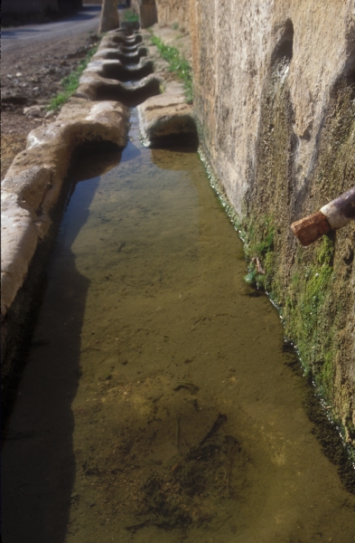
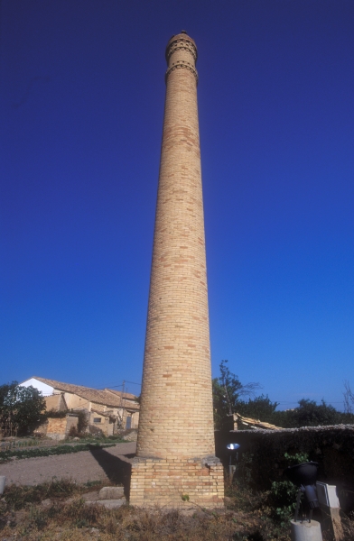
Among its examples of vernacular architecture and engineering are the twowash houses, one known as Lavadero de los Apestados (wash house of the plague-ridden) and the other known as the Fuente de Abajo (lower fountain), the olive oil mills that are scattered around the area, such as Molí Nou (New Mill), La Torreta (the Little Tower), the old textile mill and the traditional communal bread oven. And finally, a visit can be made to the museum located inside the 19th-century house once belonging to Peregrina Vallés, which features Art Nouveau (Spanish Modernista) and historicist decoration and houses the Antonio Gracia Briz Ethnographic Collection sponsored by the CB Torrevelilla Cultural Association.
Between 21 and 24 August, the town holds a festival in honour of Saints Joachim and Mark.
Torrevelilla is the headquarters of the Bajo Aragón-Matarraña Local Action Groupwww.omezyma.es
RECOMMENDED LINKS
Programme "Small but not invisible" broadcast on Aragón TV devoted to Torrevelilla
For more information on the cultural heritage of Torrevelilla
Scenic and Environmental Catalogue.
To watch the programme "Pequeños pero no invisibles" (Small but not Invisible) broadcast on Aragón TV devoted to Torrevelilla, clickHERE
Welcome to Puigmoreno, a town in the Lower Aragon region and part of the city of Alcañiz. It lies at an altitude of 310 metres above sea level, next to the hill of Puigmoreno, from where it took its name in recent times. It is 10 kilometres from Alcañiz proper and 4 kilometres from its neighbour Valmuel.
Archaeological excavations in the area have discovered remains dating between the Bronze Age and the Iberian and Roman period. After the Christians reconquered the area from the Moors in the 12th century, as with the rest of the lands of Lower Aragon, King Alfonso II of Aragon donated the area to the Military Order of Calatrava, whose cross is still to be seen in the doorway of the Masada de la Orden (Farm of the Knights) located in the vicinity. This led to the Commandery of Alcañiz administering and governing the entire region. After this time, the area became home to mainly farms, most of which were inhabited until the Spanish Civil War.
The village as it is known today was founded in the mid-20th century. In the 1950s the Spanish government's National Colonisation Institute, through its General-Directorate for Devastated Regions, created a series of hydraulic infrastructures to promote agriculture in areas devastated by the civil war. In the case of Lower Aragon, the purpose-built villages of Valmuel and Puigmoreno were planned for the area near to the River Regallo.
The locality was originally named Campillo de Franco, later changed to Puigmoreno de Franco. With the arrival of democracy in Spain, the reference to the former dictator was removed and the village was officially known as Puigmoreno.
Like Valmuel, Puigmoreno was laid out by the architect José Borobio according to the architectural current of rationalism, which essentially gave priority to function.
Both villages were surrounded by fields and laid out around a central square, where the most important buildings were located. This is the case of Puigmoreno's church, with its tall circular tower. It is accompanied by the fountain, health centre, government building and community centre.
The houses built for the new settlers were equally simple, with a yard in the rear for keeping animals. The Val de Zafán railway line also passed through Puigmoreno, and although it is now disused, the locality's request-stop station, built in stone with austere lines and semicircular arched doors and windows, still stands.
Life in Puigmoreno takes place in its wide and airy, tree-lined streets, made for strolling and enjoyment. The locality is a living example of Spain's recent history, of which more can be learnt with a visit to the Interpretive Centre for Settlers, opened in 2008 in neighbouring Valmuel.
RECOMMENDED LINKS
For more information on the cultural heritage of Puigmoreno


