


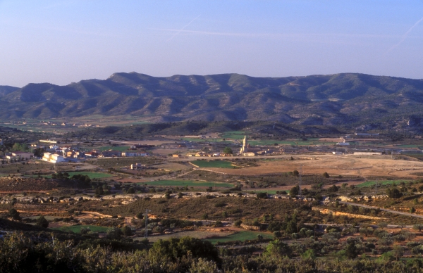
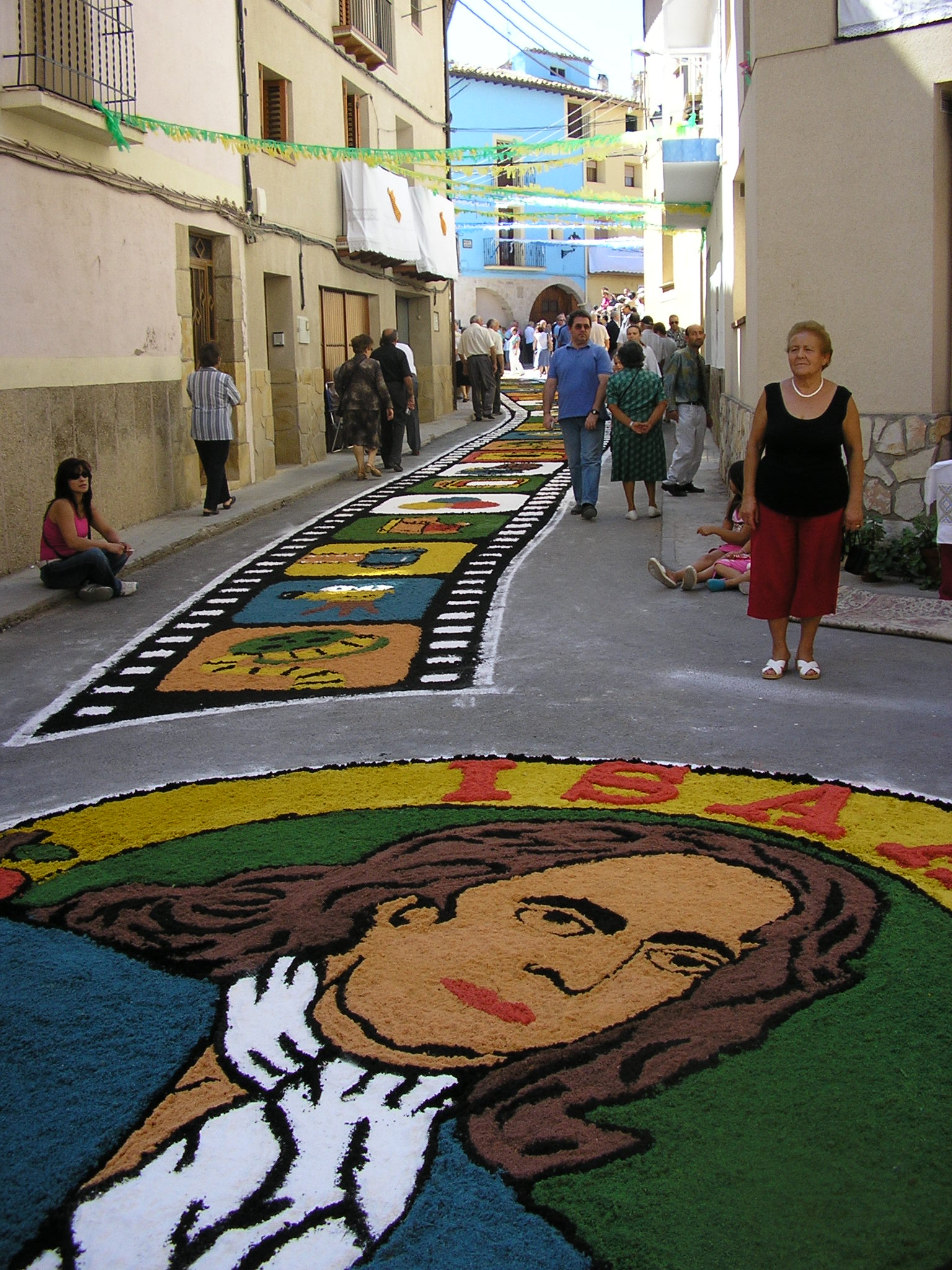
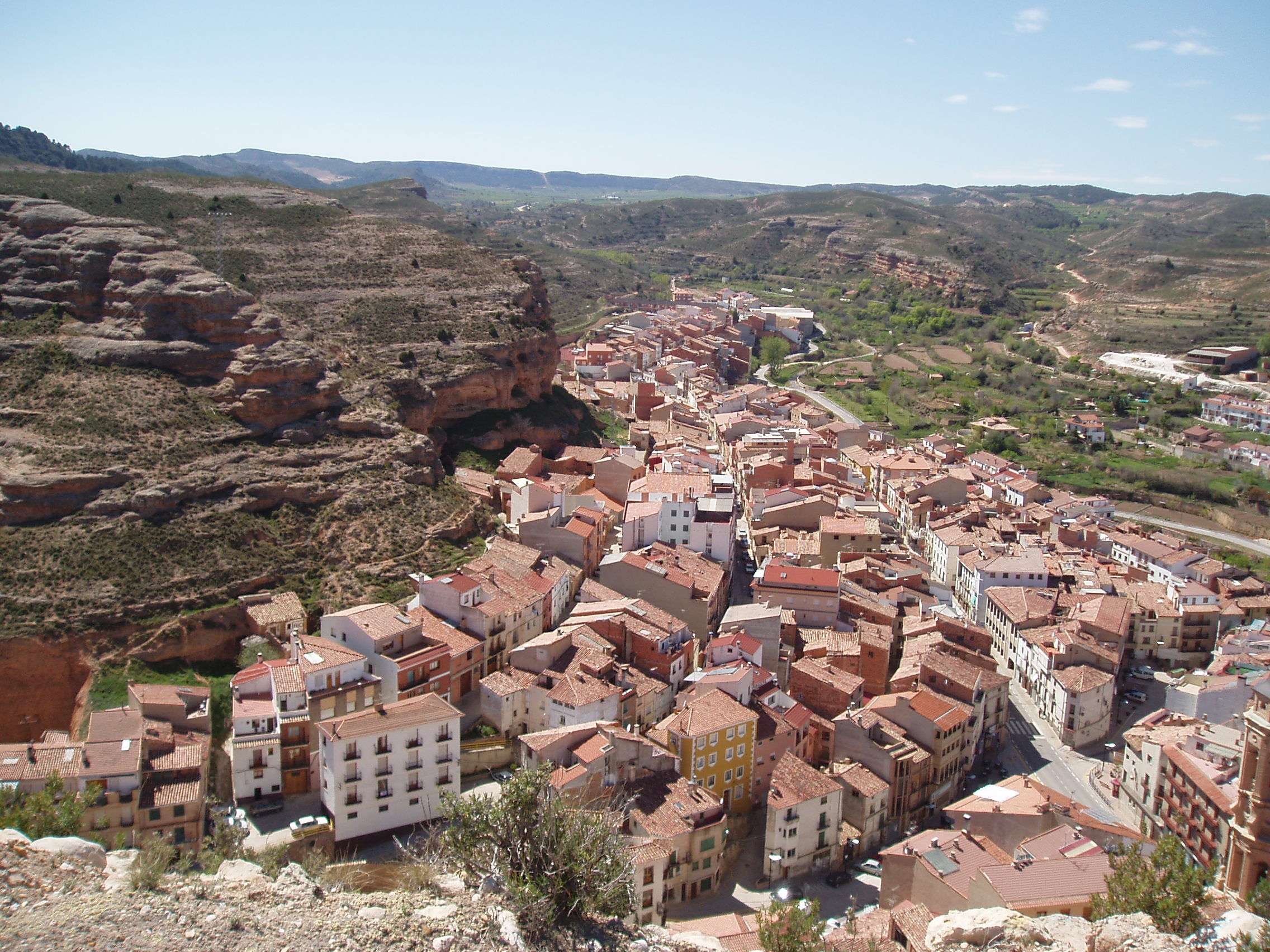
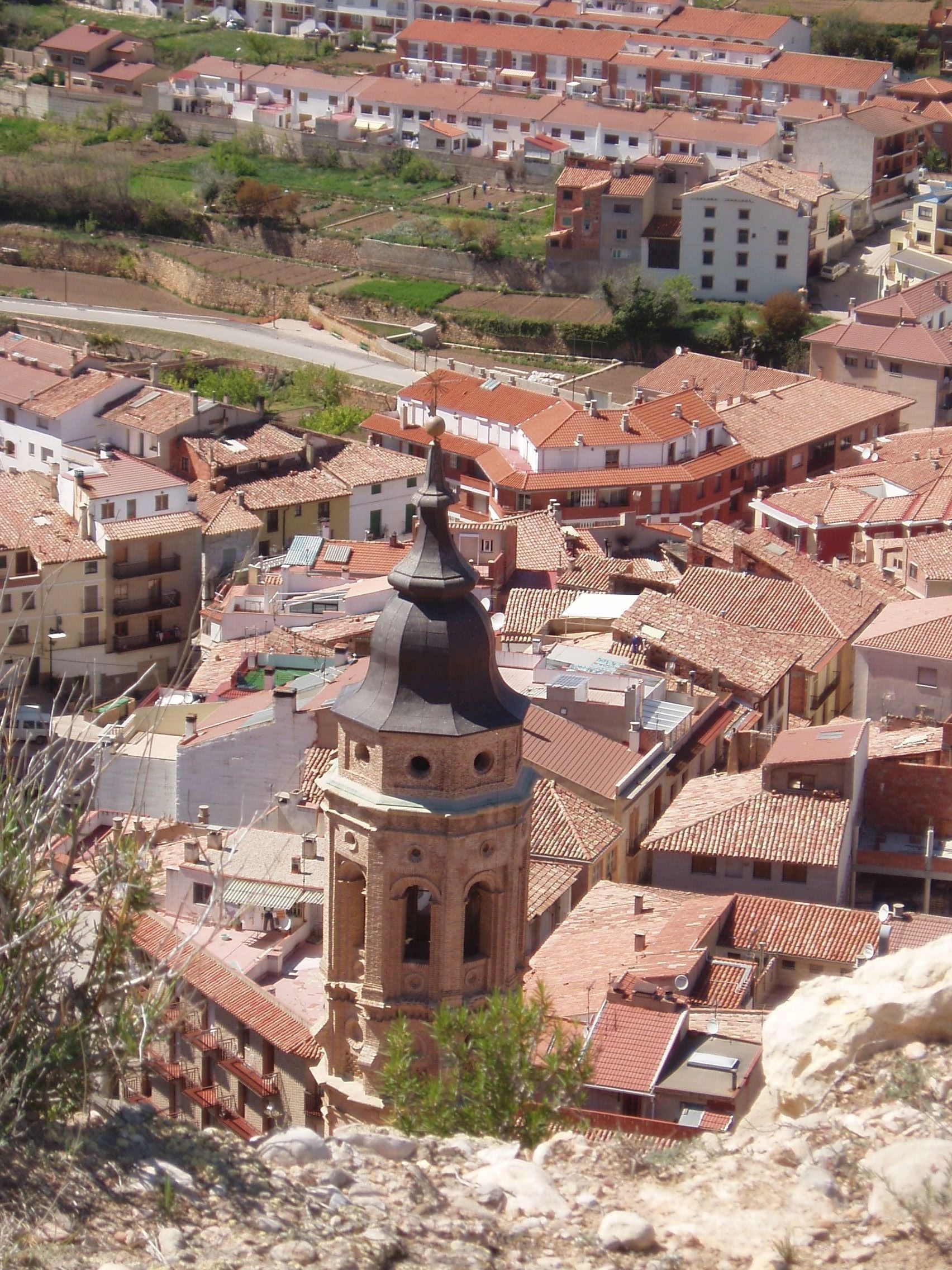
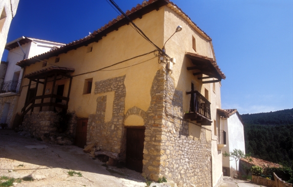
Welcome to La Ginebrosa, a town in the Lower Aragon region, located between the Rivers Bergantes and Mezquín, 28 kilometres from Alcañiz. Its name is derived from ginebre, the Catalan word for juniper, in reference to the abundance of this bush in the area.
There is evidence of early human activity in the area, such as the Ancient Iberian settlement on Mount Catma. The present-day town dates from the Christian reconquest of the area from the Moors during the reign of King Alfonso II of Aragon, who donated this land to the Knights Hospitaller. Resettlement of the area by Christians began in the 12th century, and Artal de Alagón, whose family governed the area, granted La Ginebrosa its town charter in 1291.
Evidence dating back to this period can be seen in the ruins of Buñol Castle, within the municipal boundaries of La Ginebrosa and 7 kilometres from Mas de las Matas, where plentiful archaeological finds from the Moorish period and later Christian Reconquest have been excavated.
It is known that in the 16th century, the king forbade the Knights Hospitaller from selling the municipality to the Count of Aranda, which led to La Ginebrosa becoming a part of the lands controlled by the Military Order of Calatrava.
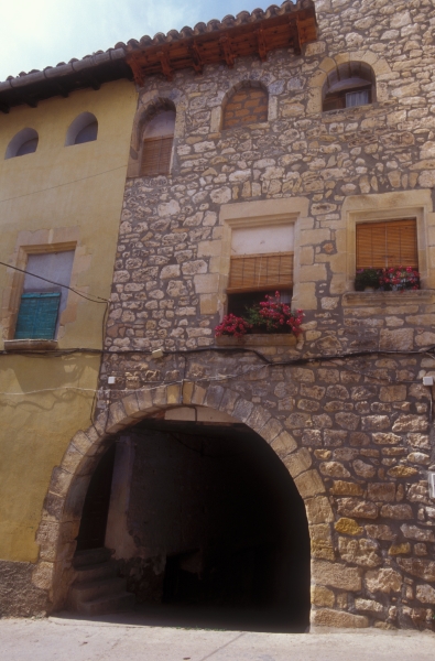
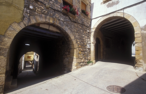
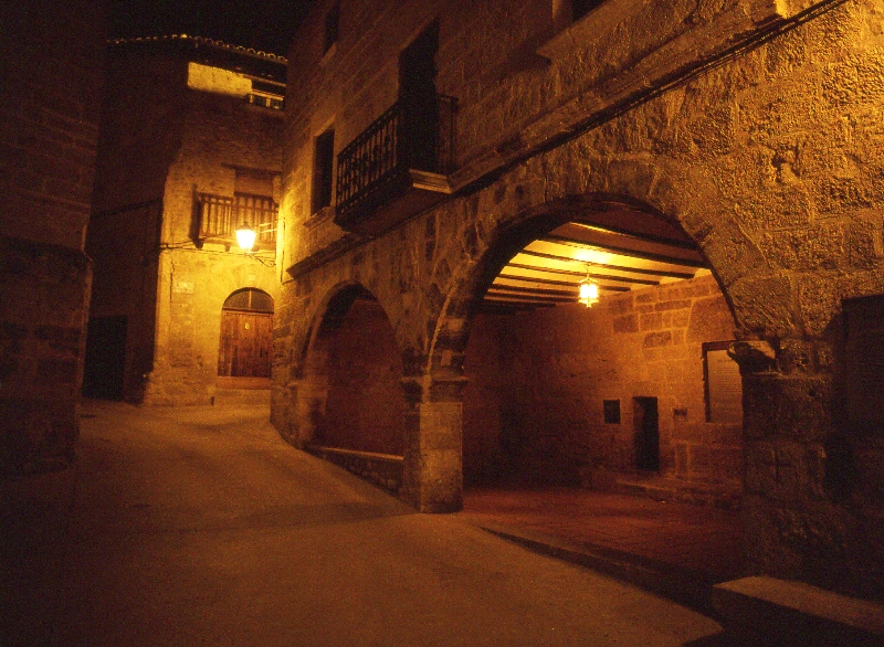
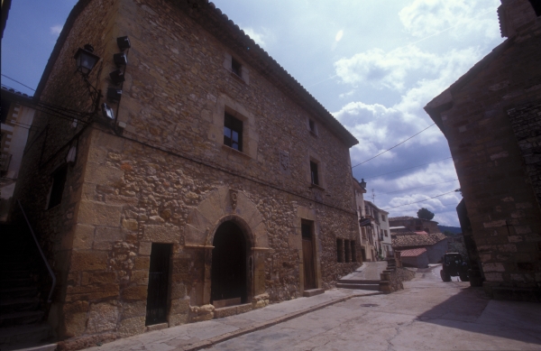
Of the five gates in the town wall, only one still stands, the one allowing entry from the south-east. The town has a typical medieval layout, with arches and passageways. This is the case of the house known as Casa Bayle, with an L design that is dissected by a narrow street; that of the building that houses the cultural centre, with a passageway connected to the main square, Plaza Mayor; and the many arches such as the one over which the old convent is built, the Herrería Arch, and the arch connecting the main street, Calle Mayor, with Calle Pilar. The aim of furthering knowledge on this aspect of La Ginebrosa has led to creation of the Interpretive Centre for Medieval Urban Design.
The arcade surrounding the Plaza Mayor, forms part of a number of important buildings, such as the town hall, which combines medieval and 17th-century architecture. The pointed arches open into a space that once housed the market on the ground floor, while the upper floor has rounded arches and wrought iron balconies.
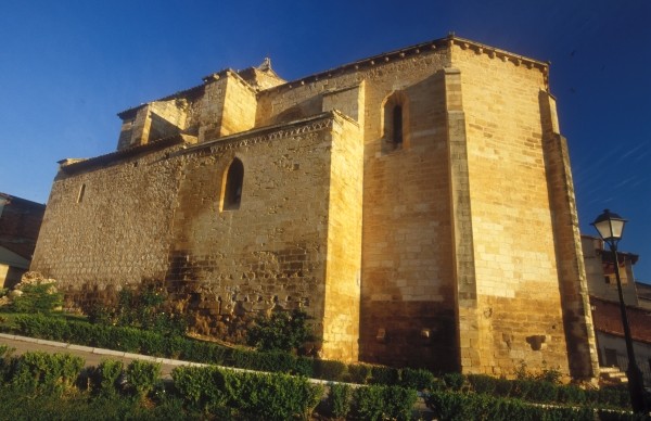
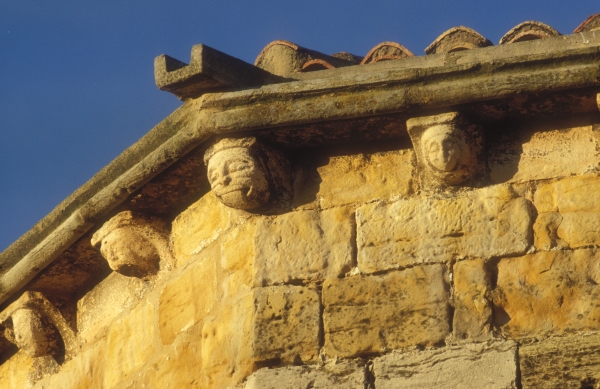
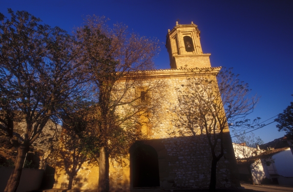
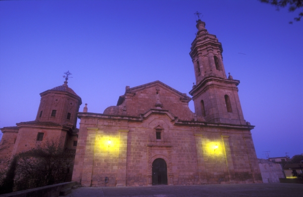
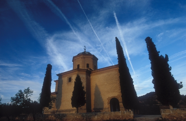
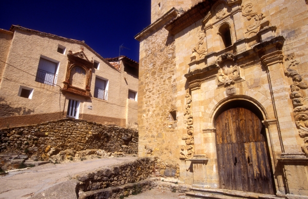
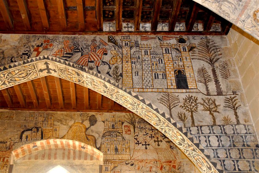
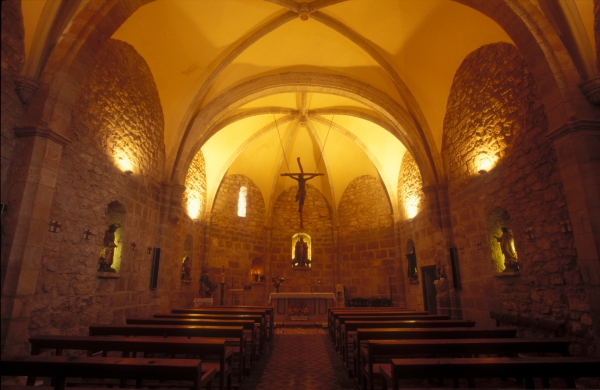
Most imposing of all the monuments in La Ginebrosa is the church of de San Bartolomé, built in the Gothic style in the 14th century and later remodelled in the Baroque style. Of the original construction, the apse and the first section of the nave are still preserved. The rest of the church corresponds to the second stage, with profuse ribbed vaulting, decorative mural paintings and stuccowork, and the main door in the classical style with a square tower to one side. The town has important examples of vernacular architecture, such as the wash house.
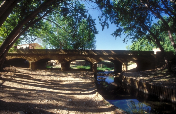
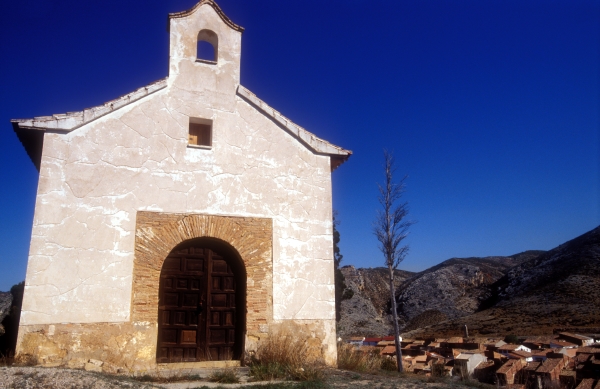
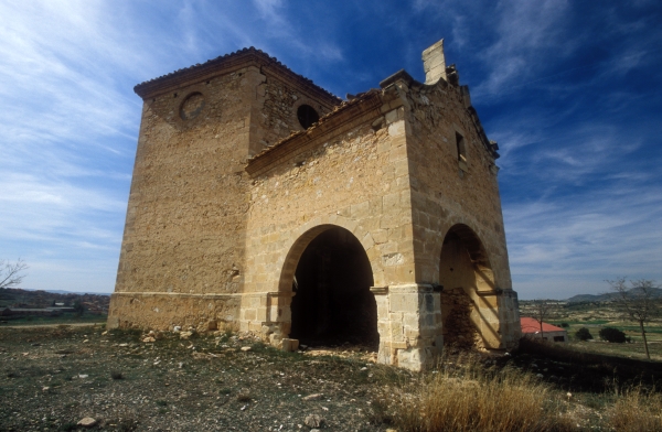
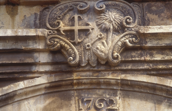
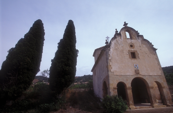
Other sights of interest that should not be overlooked are the 19th-century chapel of Santa María Magdalena, located in the area known as Las Masadetas, where the Cherry Festival is held. Other examples of vernacular architecture and engineering include the communal bread oven, the two ice houses that are included in the Route of the Ice Houses and Cold Vaults and the remains of the old dam. Built across the River Guadalope, it is part of the hydraulic works commissioned by Prince Antonio Pascual de Bourbon, son of King Charles III of Spain, from one of the country's most important 17th-century architects, Juan de Villanueva. Therestored Bridge of Cananillas can also be found in a beautiful natural setting.
This locality is also home to a communal ice house, which is included in the Route of the Ice Houses and Cold Vaults. Facing north and located close to the town proper, it is circular in design and was built using masonry filled with mortar. It is entered from the side by means of stairs that gives access to the lower part. It offers an exhibition describing the disuse and abandonment of the ice house as a result of the introduction of refrigeration. A series of illustrations and posters from the period offer a glimpse into this part of Spanish history. The ice house was in operation until the 1930s.
To see the Ice House in LA GINEBROSA: collect the keys at the swimming pool bar.
ROUTES FROM LA GINEBROSA
The Sinkhole Trail is a long, circular route that can be walked completely or in sections, depending on visitors' physical condition and available time.
The route from La Ginebrosa leads to the Sima Grande (Big Sinkhole) along the scenic ridges of the mountain range, returning via the same path. This is the most attractive part of the circular route. If taking the circular route, you take the trail that descends from the Sima Grande before crossing the road to Aguaviva and arriving at Las Maladetas, near to where the Sima Pequeña (Small Sinkhole) is located. Not far away is Los Fontanales, natural springs that are a drawcard for this route. To reach them, take the signposted detour, which leads a few hundred metres from the circular route.
To finish, the trail returns to La Ginebrosa by means of farm tracks, some of which run parallel to the La Cañada Ravine and end next to the locality's interesting ice house.
Click here to access Wikiloc with the trail to the Sima Grande.
RECOMMENDED LINKS
To watch the programme "Small but not Invisible" broadcast on Aragón TV devoted to La Ginebrosa
For more information on the cultural heritage of La Ginebrosa
Welcome to Foz Calanda, a town in the Lower Aragon region, located in the Guadalopillo Valley, 22 kilometres from Alcañiz. Its name probably derives from the location of the town, in a valley which is accessed by means of a foz or gorge, which is connected to the town of Calanda. Other theories relate the name of the town to the fact that it once belonged to the Alfoz de Calanda, territory administered by this town.
Evidence of the earliest inhabitants of the area have been discovered at Cueva Moreno, close to the town, which is an interesting archaeological site dating from the Middle Bronze Age. Important traces have also been found dating from the time of the Ancient Iberians. This is the case of the pottery kilns at the El Olmo and Mas de Moreno sites, located on the banks of the Guadalopillo some 4 kilometres from the town. They are currently being excavated and are included in the “Route of the Iberians”.
What we know of the town's history is that after the Christians reconquered the region from the Moors, it belonged to the Military Order of Calatrava, but it changed ownership over the years, passing from the control of the knights of the order to that of different families.
 Located at the highest point of the town is the church of San Juan Bautista. This elegant Baroque church built almost entirely in masonry, has a nave and two aisles, the latter much smaller than the nave and are more a series of interconnected chapels. The octagonal tower, built in brick, rises directly from the façade and houses the bells. Further up the hill from the church are the few remains of the old castle. Plaza Mayor, the main square at the centre of the town, is home to the town hall, which is entered via the typical space that once housed the market. The building features large cantilevered eaves and the niche-chapel of San Roque raised on stone pillars. One of the most striking sights in Foz is the old pottery kiln, recently restored, which bears witness to the long-standing tradition of pottery in the municipality, which was also the birthplace of such figures as the internationally renowned sculptor Eleuterio Blasco Ferrer.
Other existing examples of this type of vernacular architecture are the old ice house or snow cellar, and the stone cistern. Examples of religious architecture that cannot be overlooked in Foz, include the chapel of Santa Bárbara, built in the 19th century on the Monte del Calvario (Mount Calvary procession route), commanding a view over the entire town; and the chapel of Nuestra Señora de las Nieves, built in 1979 to replace the old chapel that was flooded by the waters of the reservoir.
Finally, there are also important examples of natural heritage. This is the case of landscapes such as the Peña del Cucón and Val de la Piedra, the location of a great holm oak standing 14 metres high with a crown measuring 32 metres in diameter.
RECOMMENDED LINKS
For more information on the cultural heritage of Foz Calanda.
Welcome to Aguaviva, the gateway to the Lower Aragon region from the neighbouring province of Castellón. It is located in the Mas de las Matas Basin and is crossed by the Rivers Guadalope and Bergantes, the waters of which are most likely the origin of the name of the town (agua being the Spanish for water).
Aguaviva was founded after the Christians reconquered the region from the Moors under King Alfonso II of Aragon in the 12th century. It would depend on the Commandery of Castellote, first under the control of the Military Order of the Holy Redeemer (Knights of Mountjoy), later that of the Knights Templar, and finally under the Knights Hospitaller.
In the 17th century Aguaviva gained its independence from La Ginebrosa, of which it was initially an outlying district, but was later incorporated into the administration of the city of Alcañiz. Its streets were the setting of a very important battle in 1838, during the First Carlist War, in which the government forces were victorious.
Aguaviva is today bears witness to its present and past. A stroll along its streets soon takes visitors to a beautiful square, the Plaza de España, surrounded by arches and divided into two levels connected by a staircase.
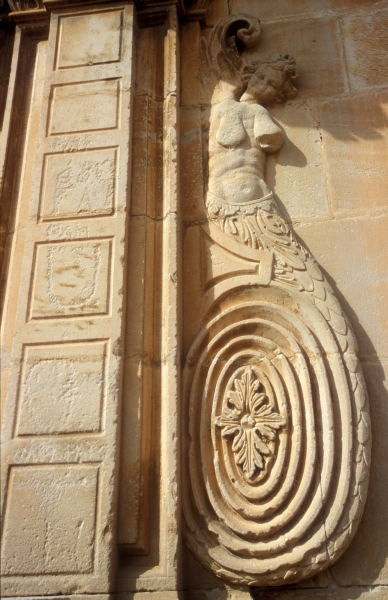
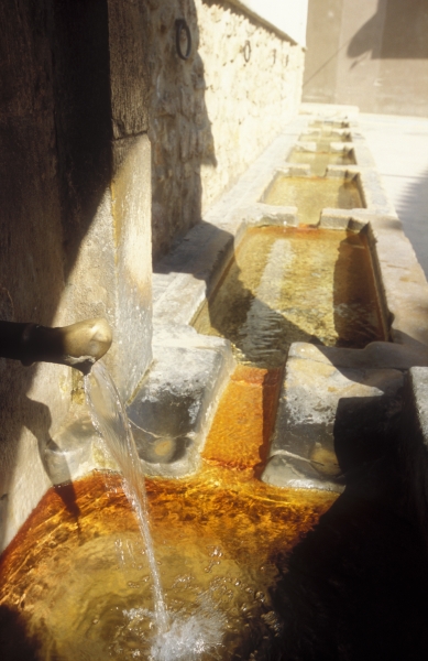
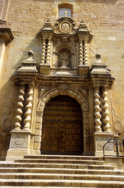
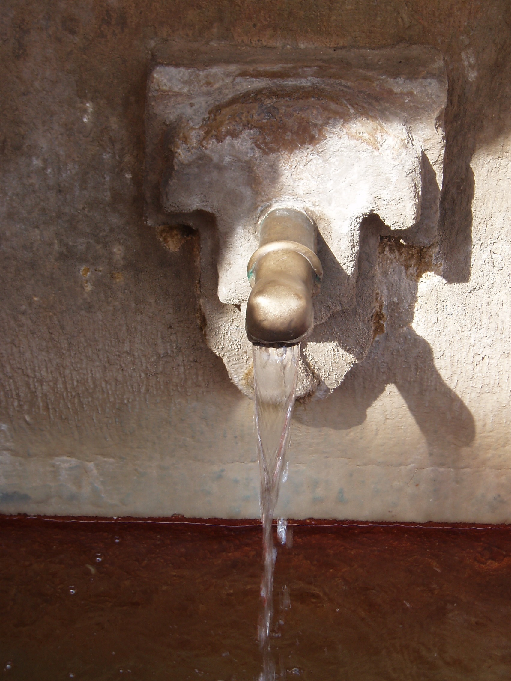
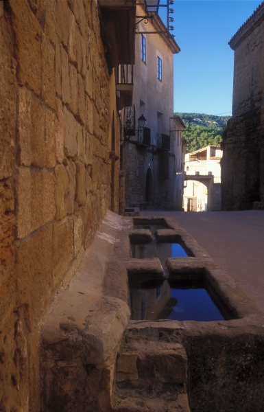
Continued exploration leads to other examples of outstanding architecture, such as the Renaissance mansions scattered throughout the town, among which is Casa Mir, found in the street Calle Larga. Dominating the otherwise homogeneous roofline of Aguaviva, is the parish church. This magnificent Baroque building, dedicated to Saint Lawrence, stands in the main square, Plaza Mayor. Built in the 17th century entirely from ashlar blocks, the church has a rectangular layout with a nave and two aisles, and a polygonal apse. Among its features are a splendid bell tower, the Chapel of the Mystery (Miracle) and the side door, flanked by two enigmatic female figures with serpentine tails. The ecclesiastic heritage of Aguaviva is completed by its two Baroque chapels located just outside of the town and dating from the 17th century, built in honour of Saint Gregory and Saint Barbara, respectively Finally, in a town so closely connected to water, there are a number of interesting examples of historic hydraulic engineering: the old flour mill, built in 1738; the ice house, a part of the Route of the Ice Houses and Cold Vaults; the recently restored Cananillas Bridge; and the complex consisting of the fountain and public wash house.
RECOMMENDED LINKS
For more information on the cultural heritage of Aguaviva
Scenic and Environmental Catalogue.
Welcome to Alcorisa, a vibrant and welcoming locality in Lower Aragon, which proudly bears the honorific titles of “Faithful” and “Most Illustrious”, granted to it by the Spanish King, Philip V. The town was originally known as Alkol, derived from the Arabic al kura, meaning “the farmsteads”. The origin of its current name, Alcorisa, is not clear, although it is thought to derive from the Spanish word alcor or hill, a reference to the many hills in the area.
Whatever the case, Alcorisa is located in the midst of fertile land inhabited since time immemorial by different cultures. The earliest evidence of human activity to date can be found at the archaeological sites of Fila de la Muela, El Morenillo and Mas del Hambre. The first permanent settlement discovered to date is the Iberian village found at Cabezo de la Guardía, listed on the Aragonese register of cultural heritage sites in 2001, where fragments of painted pottery and the ruins of Roman baths have been found. This site is now a part of the Route of the Iberians in Lower Aragon, an interesting initiative for archaeological and cultural tourism based on the culture of the Ancient Iberians in the east of Aragon.
After the Christians reconquered the region from the Moors, Alcorisa was included in the lands donated by King Alfonso II of Aragon in 1179 to the Military Order of Calatrava, and was incorporated into the district of Alcañiz in 1263. The locality gradually grew in population and wealth until, in the late 16th century, it became a thriving town that desired more independence in order to control its own affairs. In 1591 it was granted autonomy by Spanish King Philip III to exercise civil jurisdiction in minor matters, but it would not be until 1605 when, after years of legal battles and appeals, the king granted Alcorisa its long-awaited town charter, which, as specified by royal privilege, envisaged the following:
“ … henceforth the inhabitants of Alcorisa shall be and shall be understood as separated and exempted from the city of Alcañiz and its civil and criminal jurisdiction, with their lands and boundaries.”
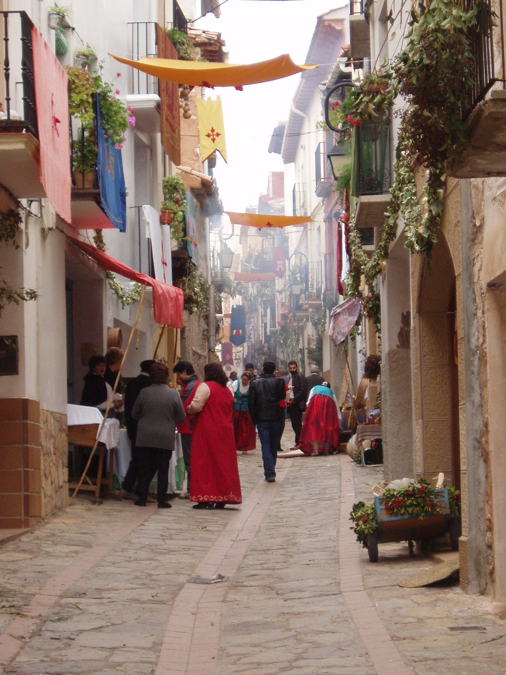
This historic event is now commemorated by the the residents of Alcorisa through the celebration of the Festival of the Town of Alcorisa, a mass hisorical recreation that takes place every two years and which gives the town the feel of what it used to be like during Spain's Golden Age.
One of the most striking sights visitors have when they arrive in Alcorisa is that of the abrupt hills that rise from one of the sides of the town, and the silent duel they have maintained over the centuries with the verticality of the bell tower of the parish church. It is this nearby natural environment, filled with beauty and charged with symbolism, which is recommended as the starting point for a tour of Alcorisa, and one that will most likely endure in the memory of visitors to the town.
The walk up via the Monte Calvario (Mount Calvary procession route) combines the beauty of a natural setting cloaked with vegetation and pines that can be enjoyed while advancing along a paved path that takes the form of a Stations of the Cross laid out in the 16th century. Peirons, marker columns with religious images, and chapels appear to visitors, as well as quiet spaces with views over the town and surroundings. Along the way, it is possible to catch sight of wild goats, inhabitants of this place, which have now become part of its appeal. Close to the top of the hill is the chapel of El Santo Sepulcro, one of the symbols of Alcorisa, dating from the 16th century. Visitors are invited to enjoy a moment of serenity before continuing to the top. Once there, and leaving to one side the 17th-century chapel of San Juan, turn towards the natural vantage point that is the Peña (rock) of San Juan in order to enjoy the magnificent scenery before you, with the domed bell tower of the church rising in the foreground.
Monte Calvario is also the natural setting for the Passion Play, which for almost thirty years has drawn thousands of people to Alcorisa on Good Friday and which has become not only one of the leading drawcards for the Alcorisa Holy Week celebrations, but also for the Drum Route of Lower Aragon. The well-selected natural stages add realism to the play, which combined with the quality and enthusiasm of the actors, leave believers and non-believers alike in awe year after year with each scene.
 After descending, the visit continues with the obligatory view from the staircase leading to the church of Santa María la Mayor to delight in the beauty of its Baroque façade and monumental bell tower (18th c.) with its decoration reminiscent of the Mudéjar style. This landmark was listed on the Aragonese register of cultural heritage sites in 2002.
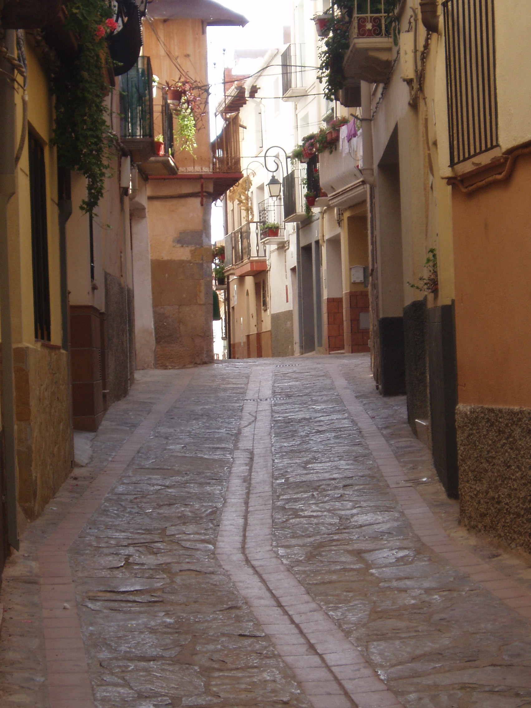
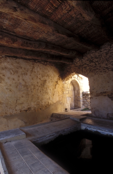
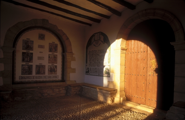
After visiting the complex comprising the refreshing Fountain of the Three Spouts (18th c.) and the public wash house, which is still in use today and where it is possible to see women washing clothes in the style of bygone years, the visit continues through the streets of the historic quarter that retains its medieval layout. Here one finds niches with statues and small niche-chapels honouring the saints that give their names to the streets, and examples of Aragonese vernacular architecture that coexist with shops and charming spaces. Special mention should be given to the Plaza de los Arcos, a square in which a great many historic events have taken place.
The visit to the old town ends with the church of San Sebastián (18th c.) which has been completely restored and now houses the Holy Week Interpretative Centre, the Rural School Museum and the visitors' centre for the Route of the Iberians.
For more information on the cultural heritage of Alcorisa.
Welcome to La Codoñera, a town in the Lower Aragon region, located in the Mezquín Valley, 16 kilometres from Alcañiz. Its name is derived from the word codony or quince, owing to the abundance of this fruit tree during the period of Christian resettlement after the area was reconquered from the Moors.
The earliest traces of human activity date back to the Aeneolithic period, about 3000 BC, and the existence of an interesting Ancient Iberian settlement has been discovered on Santa Bárbara Hill.
 The earliest written records referring to the current town date back to 1225, which mention that it was a hamlet dependent on Alcañiz and belonged to the Great Commandery of Calatrava, under control of the knights of this military order. La Codoñera was in the Alfoz de Alcañiz, territory administered by the city, and was part of the lands donated by King Alfonso II of Aragon to the Military Order of Calatrava after the area was reconquered by the Christians from the Moors in the 12th century. This situation gave rise to a long struggle for independence until 1624, when the locality gained a certain degree of municipal autonomy through a treaty.
On 21 May 1776, King Carlos III of Spain granted La Codoñera its town charter, on account of its 200 useful residents, and separated it from the jurisdiction of Alcañiz. Another important historic moment came on 12 October 1833 when Colonel Manuel Carnicer announced his support for Prince Charles, pretender to the Spanish throne, in La Codoñera, a few days after the death of King Ferdinand VII, ushering in the First Carlist War.
The town contains interesting architectural works that reflect progress of the town. Among these is the church of La Asunción de Nuestra Señora. Construction began in the 13th century and endured through different periods of time. Its final appearance is mainly in the Baroque style, with Solomonic columns flanking the main door, a barrel vault with lunettes, and a large bell tower. Traces remain of its Gothic origins, such as the polygonal apse and chapels with fan vaulting. Frescoes dating from the 17th century have been found in one of these. Adjacent to the church is the Renaissance-style town hall (1576-1579). It was originally built to house the Confraternity of Saint Mary and Saint Valerius, which controlled local power until La Codoñera gained its autonomy in the 17th century. Designed in the Roman Renaissance style, it embodied classical taste through the use of stone, a rounded arch over the doorway, a gallery with its typical Aragonese-style arcade and cantilevered eaves. Strategically located is a peirón, a marker column with carved depictions of the saints, which directs attention to the different chapels in the area. The chapel of Nuestra Señora de Loreto, restored in 1940 after the destruction caused during the Spanish Civil War, boasts a monumental baldachin and a beautiful dome with pendentives. Another two chapels can be visited within the municipal boundaries of La Codoñera, the chapel of Calvario, also known as the chapel of Santo Sepulcro and the chapel of Santa Bárbara, located on the hill of the same name, which is also an unrivalled vantage point.
Finally, attention should be given to the examples of vernacular architecture, such as the pelota court, the old textile mill, the ice house, the restored wash house, the ruins of the olive oil mill, and Molí Siscar, a mill located in the Fondo Ravine which was formerly used to produce flour.
RECOMMENDED LINKS
For more information on the cultural heritage of La Codoñera
Welcome to Jaganta, a locality in the Lower Aragon region and outlying district of the nearby town of Las Parras de Castellote, 3 kilometres away. It is located at the head of the Las Parras Ravine, the waters of which flow into the River Guadalope. The village is reached via the road from Las Parras or from the Santolea Dam. Until the 18th century, it was named Saganta, which is probably Indo-European in origin.
The streets and squares of Jaganta invite visitors to wander slowly while soaking up the tranquillity that seeps from the walls of the buildings. The history of the place and its inhabitants can be felt with every step. Among the most interesting buildings are the old olive oil mill and the church of San Felipe y Santiago.
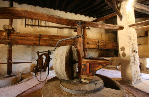
The olive oil mill of Jaganta, built in the 17th century and restored in 1995, is kept in perfect condition and is an excellent example of the pre-industrial process of grinding olives to obtain the highly prized oil of the Lower Aragon region.
It is a modest mud brick building with two openings in the wall for access and a single sloping roof consisting of a wooden frame, covered in a lattice of woven cane and topped with Arab-style clay tiles. A square turret rises over the rest of the edifice where press machinery is housed. Next to the entrance is a fountain and cistern, which supplied the mill with water.
The traditional machinery is preserved inside the mill. The millstone used to grind the olives was operated by animal traction, with an animal turning the mechanism to produce the olive paste, which was then sent to the press, comprising a huge beam made of six pieces of timber joined together with metal fasteners. This served as a lever that was operated with a counterweight, a huge stone that weighed 3 tonnes. Once the olive paste was pressed, hot water was poured into the base of the press to allow the oil to run easily through channels into basins, where both liquids were separated by decantation.
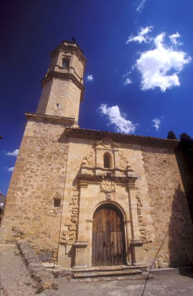
The other large building in Jaganta is the church, dedicated to Saints Philip and James. It was built in the 18th century in the Baroque style, and the date 1742 is inscribed over the door. Built in stone, it presents the features of the elegant Baroque style, and features a beautiful doorway with pilasters flanked by stylized plant motifs.
Also striking is the old pelota court with twin arches built in 1866, next to the church, and the Fountain of the Cypresses.
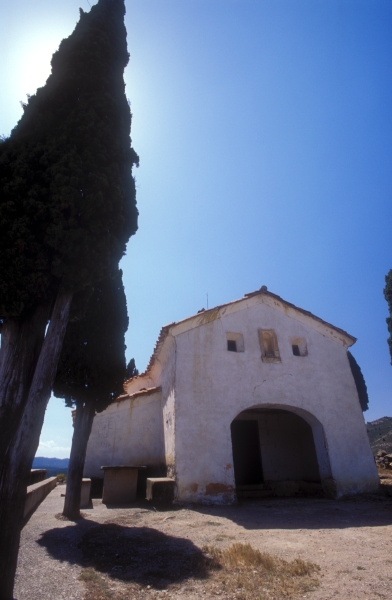
Finally, on the outskirts of the village, on the road to Las Parras de Castellote, is the chapel of San Pedro Mártir. Cypresses embellish the surrounds of this building, which is plaster rendered and whitewashed. Built in 1795 in the Baroque style, it is round with a porch over the entrance, which is defined by a diminished arch.
RECOMMENDED LINKS
For more information on the cultural heritage of Jaganta
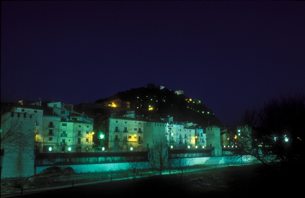
Welcome to Alcañiz, the capital of the Lower Aragon region. The city lies on a meander of the River Guadalope that “embraces” the hill of Pui-Pinos. Its name is Arabic in origin, and refers to a cañizo or cane, which forms part of its coat of arms. The city's name is also accompanied by the honorific titles of “Loyal”, “Most Loyal” and “Heroic” owing to the bravery shown by it during different conflicts.
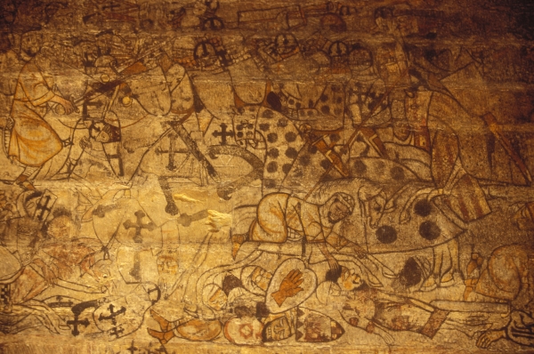
Many testaments to Alcañiz's past are still preserved and tell of its history and its past inhabitants. Evidence left by the first settlers is to be found in the cave paintings of Val del Charco del Agua Amarga, included on the UNESCO World Heritage list. The Iberian settlements discovered at the El Palao and El Taratrato archaeological sites, together with the Iberian Necropolis at El Cascarujo, all form a part of the Route of the Iberians, and there is a permanent exhibition related to them in the Old Flour Mill in Alcañiz, pending completion of the visitors' centre.
The city as it is known today was founded in the Middle Ages. After the reconquest of the region from the Moors by the Christians, Ramón Berenguer, Count of Barcelona and Prince of Aragon, granted Alcañiz its township status in 1157. In 1179 his son, King Alfonso II of Aragon, donated a large tract of land in the region to the Military Order of Calatrava.
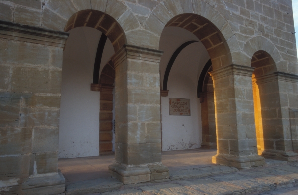
Dating from this period are the Castle of the Knights of Calatrava, perched on the hill overlooking the city, the great bell tower of the church of Santa María la Mayor (14th c.) and the majestic 15th-century merchants' exchange. In addition, the medieval underground passageways, cellar and cold vault have been preserved and can can be visited, starting from the tourist formation office, and also the Old Flour Mill.
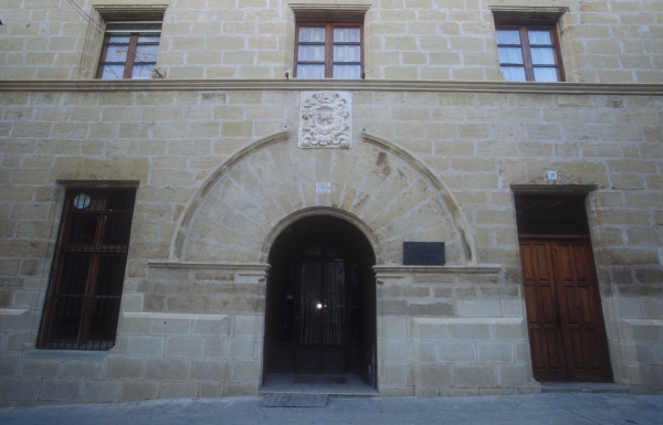
During the Renaissance, an important group of Humanists emerged in Alcañiz. This time also saw the construction of the magnificent town hall, built perpendicular to the Gothic merchants' exchange in the Plaza Mayor, and the church of Santo Domingo, now the ATRIVM Historical Space. A great many mansions were also built, such as Casa Maynar, seat of the regional administration, and Casa Ardid, which now houses the library and records office.
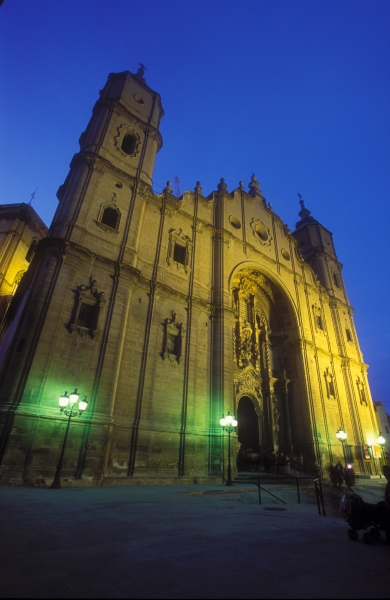
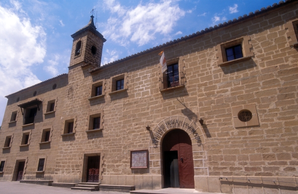
The Baroque style burst into Alcañiz and left a visible mark on the city in the form of many religious buildings. Outstanding among these is the church of Santa María la Mayor and the chapel of La Virgen de Pueyos, in addition to the churches of Carmen, San Francisco and Escolapios. This architectural style is visible in the southern section of the castle, the Commanders' Palace, today a luxury Parador hotel.
Industrialisation began on an extensive scale in the 18th century. With it came mills, furnaces and factories, among others, and the city was built up. The time of the Bourbon Restoration and the turn of the 20th century have left examples of the prosperity of those years: the beautiful Art Nouveau (Spanish Modernista) houses lining Paseo Andrade and Casa Taboada, the theatre, the market and the much-loved Fountain of the 72 Spouts in La Glorieta Park. In turn, the arrival of the railway in Alcañiz brought about industrial expansion across the other side of the river.
The 20th century saw the city grow, interrupted only by the Spanish Civil War. Development would peak in the 1950s with the construction of the purpose-built villages of Valmuel and Puigmoreno on the outskirts of the city. Alcañiz today is a living city in which the magnificence of its restored historic quarter coexists harmoniously with the modern city that has grown up around it.
It forms a part of the Drum Route, and the Holy Week celebrations in Alcañiz are a must-see, as are its medieval market and “The Defeat of the Dragon”, an event held on 23 April every year to commemorate the feast of Saint George, the patron saint of Aragon.
For more information on the cultural heritage of Alcañiz
Welcome to Belmonte de San José / Bellmunt de Mesquí, birthplace of the Regenerationist writer Juan Pío Membrado, located on the banks of the River Mezquin. Its name is derived from the Latin bellus mons (beautiful hill), to which the name “del Mezquín” was added, in reference to the river, and finally changed to “de San José” (of Saint Joseph).
A large number of archaeological sites are to be found that date back to the Iron Age and the settlement of the area by the Ancient Iberians. After the Christians reconquered the region from the Moors, the town as it is known today lay inside the lands donated by the Aragonese King Alfonso II to the Military Order of Calatrava. The knights of the order granted it a charter of privileges in 1232, and a charter of enfranchisement in 1338, which gave it the status of a town. It was a part of the Commandery of Monroyo, before coming under the administration of the city of Alcañiz in the 18th century until the division of Spain into provinces in 1833.
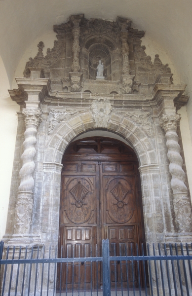
The layout of the town is reminiscent of Roman times, and and we still able to find the the original gates built into the 18th-century city walls, such as the beautiful Soldevilla Gate, which features its original stonework. Outstanding among the locality's edifices is the parish church dedicated to the Holy Saviour, built in stone masonry and ashlar in the 18th century in the Baroque style. Highly influenced by the former collegiate church in Alcañiz and the Basilica of Our Lady of the Pillar in Zaragoza (Saragossa), its nave and aisles are of equal height, in the style of a hall church. It contains a magnificent bell tower, which commands the view over the town's rooftops, and a beautiful doorway with a mixtilinear arch decorated with floral patterns. Inside, the beautiful organ, built by the Turull Brothers – master organ builders from Calanda, delights with its sound from times past. The visit leads to the centre of civic life in the town, the town hall which was built in the 16th century and later remodelled. Entry is via the old market, with its series of semicircular arches, which once housed the old jail, where the large chain with shackles used to restrain prisoners still exists. Exploration of the town's streets brings awareness of the impressive cultural heritage still preserved in Belmonte: the recently restored old communal oven with its large arches, and historic mansions, such as Casa Bosque in the Plaza Solá – now the Plaza del Pilar – and Casa Membrado.
The area surrounding the town also offers a few surprises. One of these is the magnificent ice house of the Calatrava knights, included in the Route of the Ice Houses and Cold Vaults.Built in the 16th century, with a partially buried structure and 9-metre high stone walls, it was in use by the inhabitants of the town until quite recently. There is also the La Pedrera olive oil mill and the remnants of the old textile mill.
Finally, a visit can be made to the Casa Redonda, the Torreta de los Cándidos, the numerous country chapels, particularly the one dedicated to Saint Joseph and those found on the Calvario (Mount Calvary procession route), and the beautiful scenery along the River Mezquín and the Fondo Ravine.
Recommended links
20 villages, 20 events Carta Puebla (Town Charter).
For more information on the cultural heritage of Belmonte de San José
Welcome to La Cerollera, a town in the Lower Aragon region, located between the Rivers Guadalope and Matarraña, 30 kilometres from Alcañiz. Its name is derived from acerollo, the name given to the rowan tree in Aragon, owing to the abundance of this plant in the area.
After being reconquered by the Christians from the Moors, what is now the town proper was a part of the lands donated by King Peter II of Aragon to the Military Order of Calatrava, to whom he granted the Castle of Monroyo and its outlying hamlets, including La Cerollera. This dependency gave rise to lengthy legal conflicts with Monroyo, which were not resolved until 1745, when King Philip V of Spain granted La Cerollera its town charter. As with the other towns and villages of the area, it was administered by the city of Alcañiz until 1833, when Spain was divided into provinces.
 The best way to get to know the streets and inhabitants of La Cerollera is to start at the main square, Plaza de la Constitución, site of the locality's most emblematic buildings: the church and town hall. The streets are filled with magnificent examples of vernacular architecture.
The church of Nuestra Señora de los Remedios was built in the 18th century. It is a beautiful Baroque-style church, designed along similar lines to other churches built in the Lower Aragon region at the same time, which were influenced by the Basilica of Our Lady of the Pillar in Zaragoza (Saragossa) and the collegiate church in Alcañiz. It was laid out with a nave and two aisles of the same height divided by slender piers comprising double columns. The ceiling of the nave is a barrel vault, while the aisles have lunettes and groin vaults. The front of the church has a mixtilinear main door, with a tower on the right (epistle) side of the doorway
The town hall is built of masonry and ashlar. Its façade has two semicircular arches opening into the space that once housed the market, from which the building is entered, and the former jail, today somewhat remodelled.


In the street called Bajada de la Plaza, there are other buildings of great interest, such as Casa del Mas de la Parra, Casa Peris and Casa Marcelino. Other interesting buildings include the one known as Horno Nuevo (New Oven), located at number 7 Calle Horno, now restored and used as a multi-purpose space, and Casa Borrás, located in Calle Mesón.
Casa Pallarés can be found at number 6 Calle Llana. It is a noble stone building dating from the 17th century with magnificent cantilevered eaves. It has the longest balcony in the entire region.
Finally, on the outskirts of the town standing on a nearby hill is the chapel of San Cristobal, dating from the 16th century. In the vicinity of the farmhouse known as Mas de Caubet are the ruins of an old mountain ice house.
La Cerollera also offers a piece of more recent Spanish history. The Interpretive Centre for the Guerilla Movement is a magnificent space filled with information that is completed with a visit to the guerilla camp used in the struggle against the Franco regime. Click HERE for more information and opening hours.
The muncipal council website offers visitors detailed information on short walking trails PR-TE-172: the Route of the Ice Houses, the Pas–Cova del Molí Route and the Route of the Fountains, all of which are signposted and provide explanatory panels.
RECOMMENDED LINKS
20 villages, 20 events: Procession to El Santet
For more information on the cultural heritage of La Cerollera
Welcome to La Cañada de Verich, a town in the Lower Aragon region located between the Rivers Mezquín and Bergantes, 25 kilometres from Alcañiz, the capital of the region. Its name is derived from the Latin word canna (cane) in reference to the narrow valley or canyon. The accompanying term Verich is most likely an anthroponym or surname.
Like the other towns in the area, La Cañada de Verich was a part of the land donated by King Alfonso II of Aragon to the Military Order of Calatrava, and belonged to their commandery during the Middle Ages. In 1491 King Ferdinand and Queen Isabella granted the the locality a royal charter for its resettlement, and Philip II of Spain made it a town in 1547.
As in many other towns and villages in the surrounding area, the population gradually decreased throughout the 20th century, falling from 282 registered inhabitants in 1900 to 259 in 1950. Today it only has 109 registered inhabitants.
The residents of La Cañada de Verich have traditionally been farmers, raising livestock and growing the typical crops of the area, such as olives and cereals. The great frost that affected the area in 1956 damaged most of the olive trees, leading to the planting of almond trees. This locality has some mining activity. Within the the limits of the municipality, covering some 10.9 square kilometres, are mines producing fire clay, a heat-resistant clay used in the manufacture of materials for construction and decoration. Mining activity commenced in the early 20th century, with underground extraction. For many years it employed a large number of people from nearby localities, even drawing new inhabitants, miners from more distant places who decided to move here. The introduction of machinery and open-cut mining over time has reduced the need for workers. There are currently 4 mines in operation.
Exploration of the historic part of the locality, which is built on the slope of Las Fajas Hill, soon takes visitors to the main square, Plaza de la Iglesia. Laid out with two different levels, it is the site of the main buildings of La Cañada de Verich: the church and imposing buildings, among which is the mansion now housing the town hall.
The church is dedicated to Saint Blaise. There were already reports of the existence of a church in 1324, which was highly remodelled in the late 16th century. Today we can enjoy a beautiful building that is very much in keeping with the style of the Gothic churches typical of the nearby Matarraña region. Robust buttresses surround the single nave, built with thick walls and no side windows. There is a polygonal apse and a ribbed vault. The simple doorway is topped by a narrow belfry, which gives the building its great elegance. Inside, the stillness and darkness are an invitation to prayer, and hark back to other, distant times.
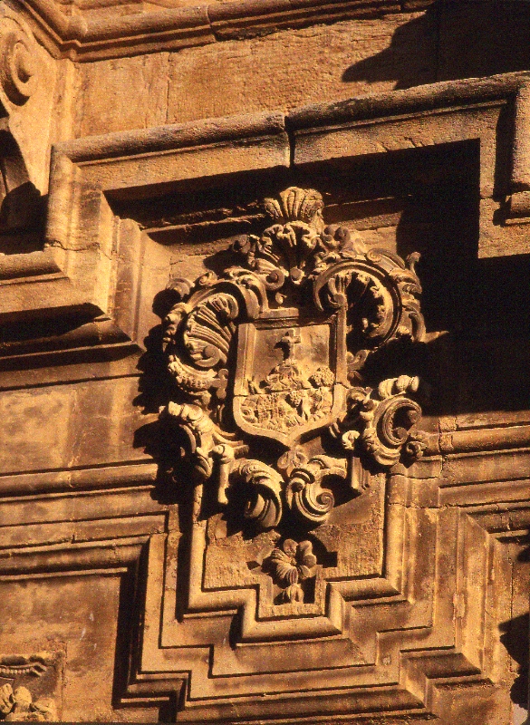
The town hall is located inside an austere but majestic mansion built by the Knights of Calatrava, and later associated with the Confraternity of Saint Blaise. The building is laid out over three storeys and constructed in masonry and ashlar. The doorway is a semicircular arch with a coat of arms carved into the keystone.
However, La Cañada de Verich has other charming places and buildings of interest. Located next to the main road is the chapel of El Pilar, a Baroque-style building dating from the 18th century with a round floor plan and domed roof: It is entered via a porch with three arches, the central arch being larger than the side ones, where the mixtilinear main doorway is found. The old cold vault, which has recently been restored, is included in the local Route of the Ice Houses and Cold Vaults. A spectacular entrance opens up into an interior vault where snow was once stored for later use. Today, its changing illumination transports visitors back in time and speaks of the life of this beautiful and functional architectural wonder. Finally, a visit can be made to the Fountain of Regall, the hydraulic engineering complex found in the Plaza de la Fuente built over two levels, the lower level channelling water to the restored wash house, in addition to the old communal bread oven, the water wheels used for irrigating the locality's vegetable gardens, and the recently restored olive oil mill, which now houses a very interesting museum dedicated to explaining the process used to make olive oil and the history of local oil production.
La Cañada de Verich is one of 11 municipalities in the Lower Aragon region included in the Cultural Park of the Maestrazgo and the Maestrazgo Geopark. Related to this is the Government of Aragon's palaeontological map that marks an archaeological site within the municipal boundaries, specifically Cañada de Verich 001, which is a series of trenches alongside the road that leads to Torrevelilla. The site is made up of different fossil remains of marine invertebrates (ammonites, belemnites, brachiopods, etc.) dating from the Jurassic period.
RECOMMENDED LINKS
For more information on the cultural heritage of La Cañada de Verich.