


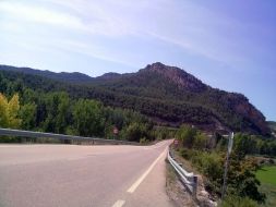
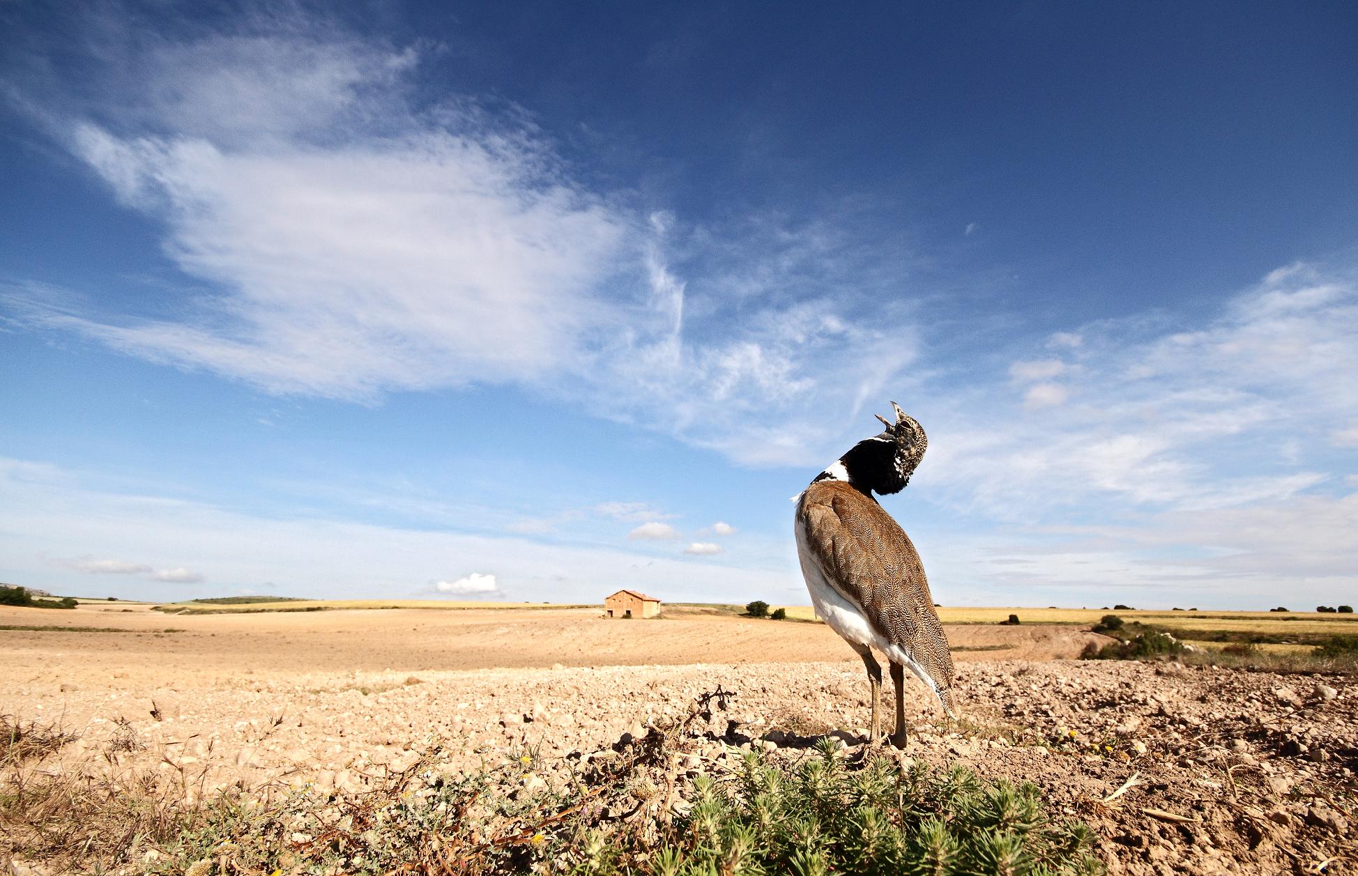
The Route of the Desierto de Calanda (Calanda Desert) and Sierra de La Ginebrosa connects the heartlands of the Lower Aragon region with one of its most wooded areas, the Sierra de La Ginebrosa mountains. This is a land of eagles, wild goats, Eurasian eagle-owls and other species that are highly wary of humans and seek the tranquillity of these settings.
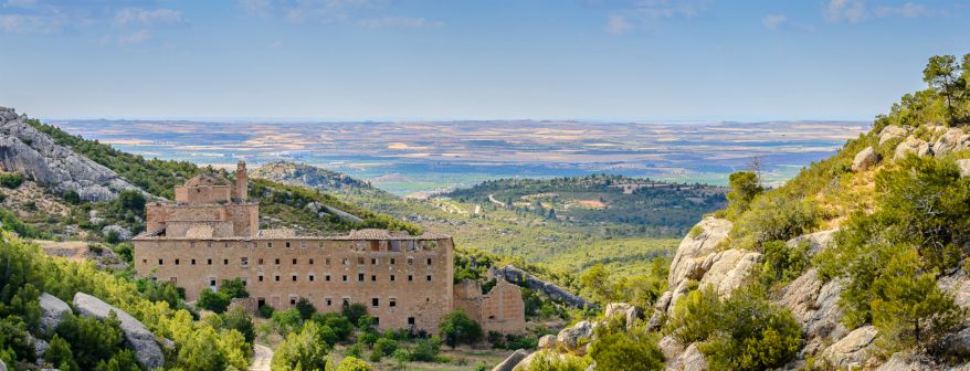
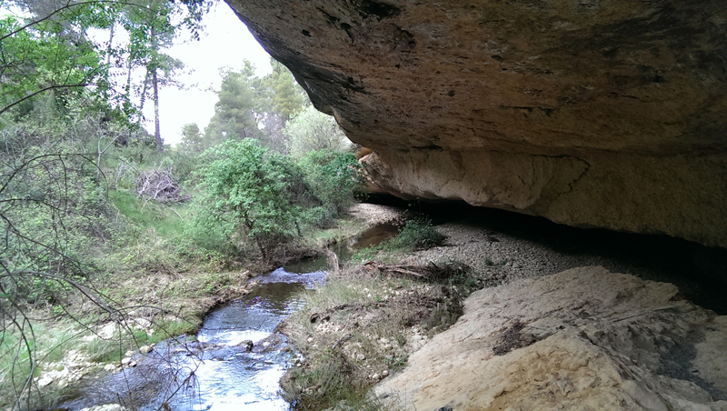
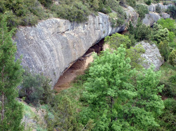
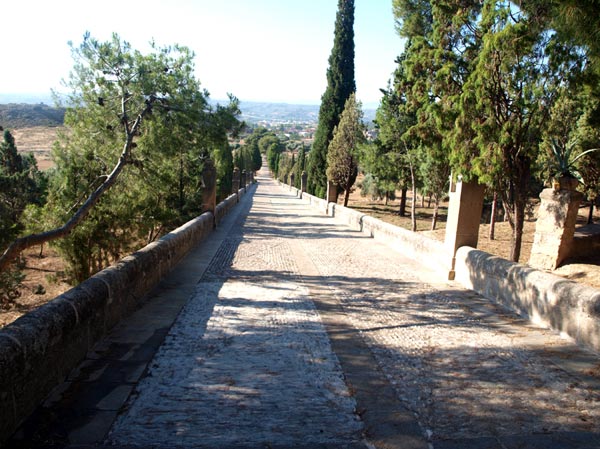
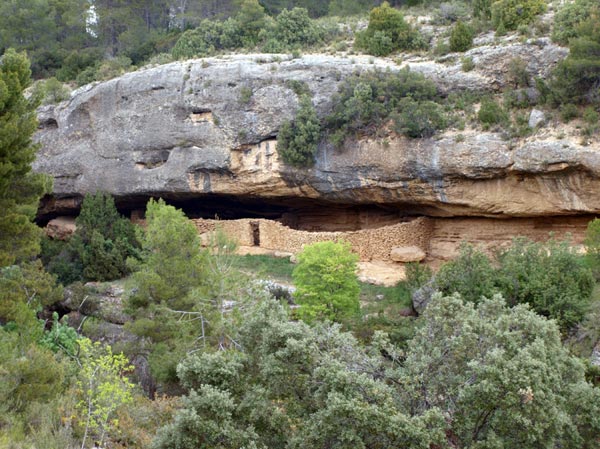
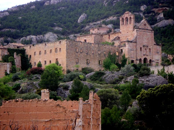
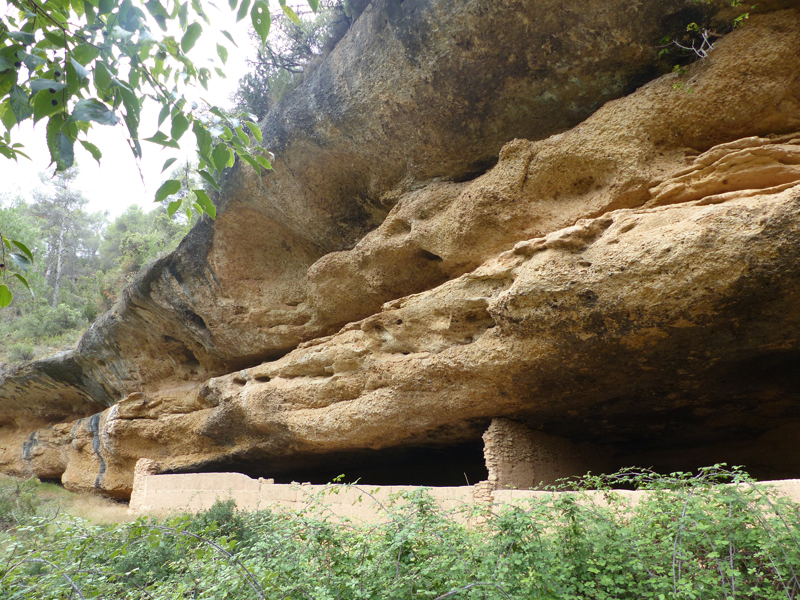
When you arrive at the junction leading either to Torrevelilla or La Ginebrosa, take the road to the former and you will arrive at the ruins of the former Convent of the Discalced Carmelites, an impressive building that was abandoned in the mid-19th century when the then prime minister Mendizábal enacted the law for the confiscation of church-owned lands. Its location in an extensive, uninhabited area led to the name of “Desierto” (desert) by which it is now known.
The Lower Aragon region has a fantastic network of signposted walking trails both short (PR) and long-distance (GR) trails. We offer you a total of 23 appealing routes through the region which we have divided into three categories so that anybody can choose the one that best suits their level of fitness.
Click on the trail that you want to take to find a detailed description of the route, map, route planner with instructions, elevation profile, other measurements and GPS tracks for download.
MARKED TOURISIM TRAILS
WALKS (Aprox 10 km)
HIJING (More than 10 km)
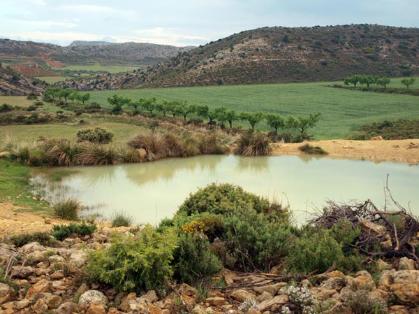
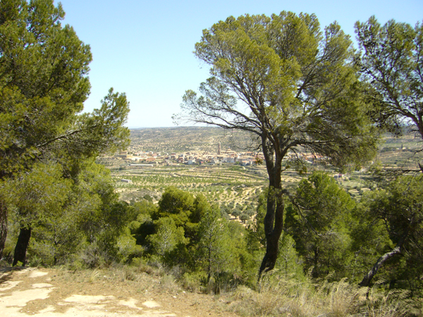
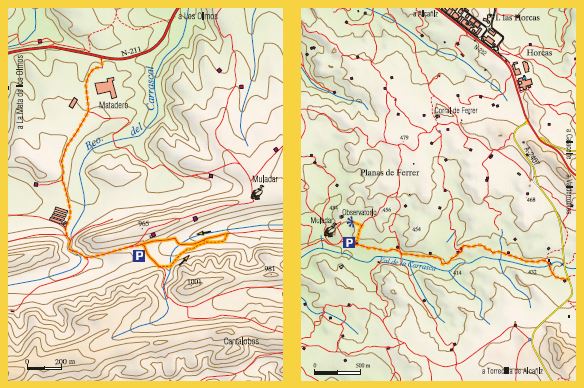
 Torrevelilla-Convento de los Carmelitas-Mirador del Pilón
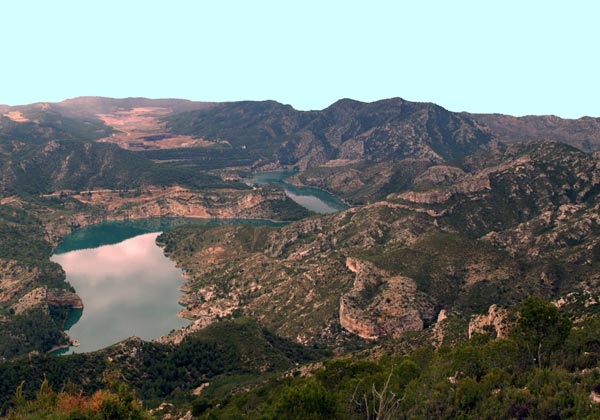

TREKKING (More than 15 Km)

LONG-DISTANCE TRAIL (GR)
GR 8: The trail crosses the south-west of the province of Teruel through a wide range of landscapes, abrupt mountains (Gúdar, Javalambre), verdant pine forests, deep ravines, rocky escarpments, springs, unexpected waterfalls... Read more
BOTANIC TRAILS
Castelserás y Torrecilla de Alcañiz: Created to honour Francisco Loscos and José Pardo Sastrón, these botanic circuits provide signage to identify native plants.
VAL DE ZAFÁN GREENWAY
The route begins at Valdealgorfa station, although it can be followed from here towards Alcañíz, in the opposite direction along the original track which is not prepared as a Greenway walking trail. The traditional architecture of this town is complemented by a particularly elegant railway building: a station designed in the Neo-Mudéjar style.
A spectacular viaduct and a number of tunnels clear the way as it passes through this wild valley. The Val de Zafán basin redirects the trail after the previous rise, as it crosses a gently sloping plain characterised by terraces planted with almond and olive trees, and stone walls, and wild and solitary land. “After the station at Valdealgorfa, the trail passes through a long, perfectly straight tunnel that has a special magic, because only twice a year, its two kilometres are penetrated by the early morning light as a fine, mysterious and ephemeral white sunbeam.”
Vive La Vía series: PROGRAMME TEMPS D'AVENTURA DE TV3
SAINT JAMES WAY
During the Middle Ages, the pilgrims' way along the Ebro Valley towards Santiago de Compostela became established, which included the route from southern Catalonia and the route from Valencia that passed through Morella and the Maestrazgo region to reach Alcañiz. The route currently passes in the vicinity of the towns of La Cerollera, La Cañada de Verich, Torrevelilla, Castelserás and Alcañiz on its way towards Zaragoza (Saragossa) between PuigMoreno and Valmuel.
This project was undertaken through the collaboration of the Bajo Aragón-Matarraña Local Action Group.
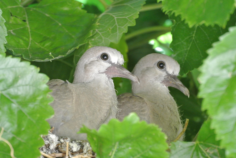
The landscapes to be enjoyed in various places in the Lower Aragon region feature a wealth of natural attractions that bird and nature lovers are sure to love. It should treated with the same tact and respect that has been shown by the inhabitants of this land through the centuries, to allow future generations to enjoy it as much as you..
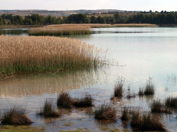
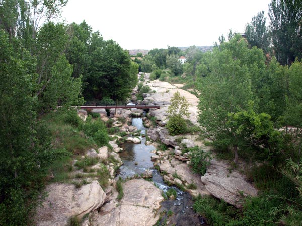
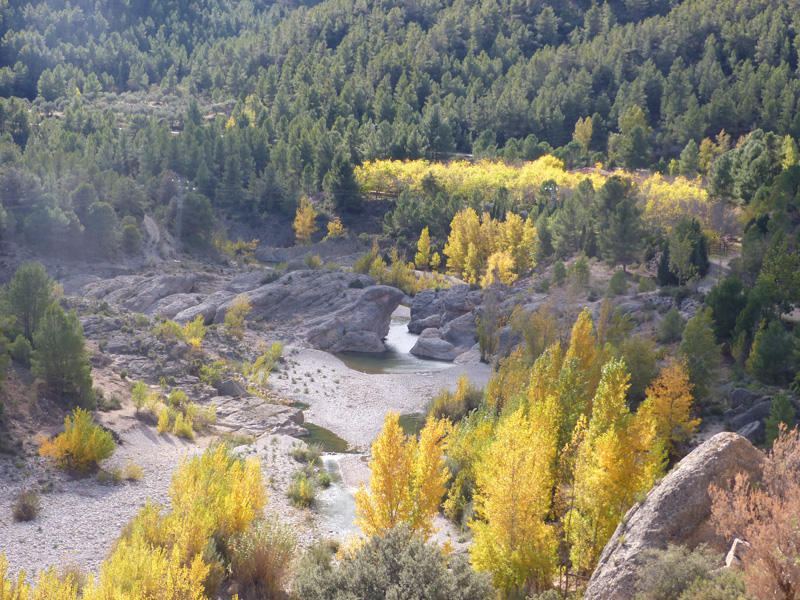
Our land is crossed by the rivers and streams, watercourses which at places have been modified by the people of the region, with the construction of reservoirs or canals mainly for agricultural use. The most important of these, because of the birds that inhabit its banks, are the rivers Guadalope, Mezquín and Bergantes.
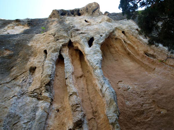
Likewise, the mountain chains that cross the region create a landscape of contrasts between the lowlands and the spurs of the Iberian Mountain Range. Geological heritage sites can be found in ten of the region’s twenty municipalities, and these are recognised by UNESCO as World Heritage sites. Some of these have been listed as geosites, such as Las Cananillas, on the River Bergantes, and the La Ginebrosa sinkholes.
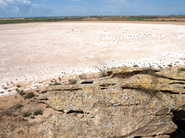
Others are protected spaceswithin the Natura 2000 network, designated as Sites of Community Importance (SCIs), such as those in the Sierra de Vizcuerno mountains, along the rivers Mezquín and Bergantes, and the Salada de Alcañiz and Salada de Calanda salt lakes. These designations acknowledge a landscape that deserves to be visited and preserved.
We invite you to observe and photograph birds at roosting sites and observatories in several places in Lower Aragon, such as those at the reservoir of La Estanca de Alcañiz or at the scavenger bird feeding stations in La Mata de los Olmos and along the road connecting Alcañiz with La Torecilla de Alcañiz.
If you are a lover of nature, rivers, birds and the beauty that is there to be seen in every tree, every plant and every village, we invite you to visit and find our more about us.
reques the "Aves y TerritoriO" (birds and region) guide
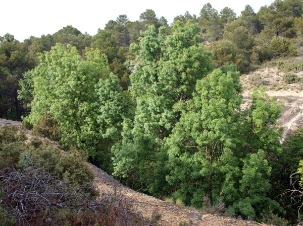
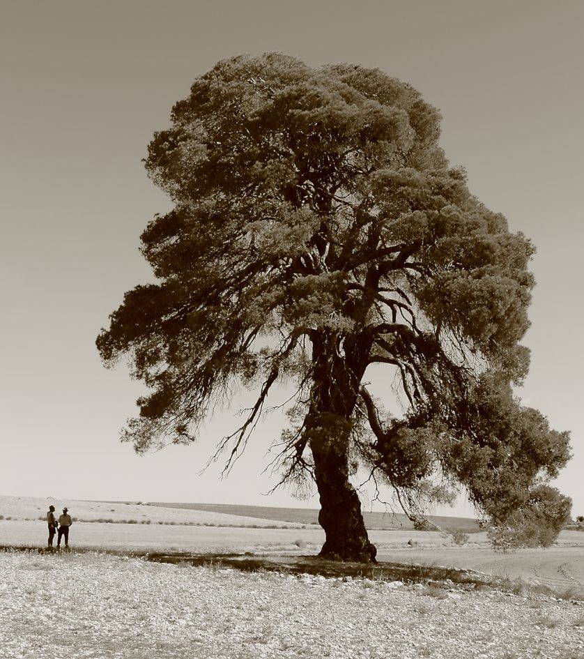
In recent years, different trees have been marked out as singular trees of the Lower Aragon and Matarraña regions. This is a route of interest for nature lovers, and there are a number of publications (brochures and guidebooks) related to it. The route allows you to discover trees that are true natural monuments.
To consult the full list of singular trees that exist in the Lower Aragon Region.
Once the link opens, access the application for consulting the Singular Trees of Aragon and the option of consulting by region. (Provincia: 44-Teruel; Comarca: 28-Bajo Aragón).
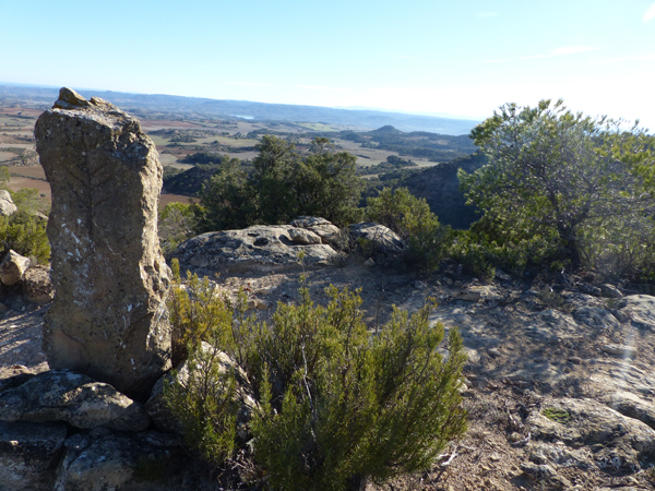
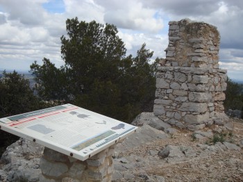
A panoramic view is an attractive way of coming to know and enjoy a place.
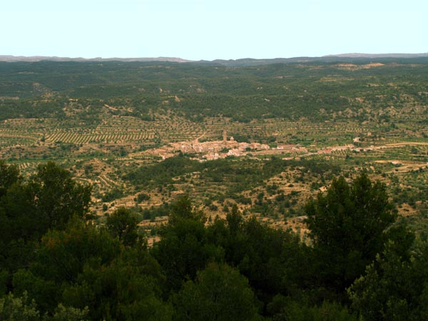
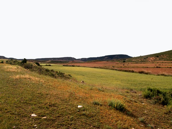
By continuing with its work to create the Route of the Vantage Points, the Lower Aragon regional administration has, in recent weeks, fitted panoramic explanatory panels for interpreting the landscape at the Castle of the Knights of Calatrava in Alcañiz and the chapel of Santa Bárbara in La Codoñera, which complement those already existing vantage points in the towns of Belmonte de San José, Castelserás, La Ginebrosa, Torrevelilla and Valdealgorfa. These vantage points, together with those set up by the Cultural Park of the Maestrazgo in the towns of Aguaviva, Alcorisa and La Cañade de Verich, allow magnificent views of this land to be enjoyed from different natural lookouts. In the region, such diverse areas such as semi-arid steppes, Mediterranean forests and so-called premontane ecosystems can be identified.
The network of vantage points is earmarked for expansion with the incorporation of new viewpoints from which to enjoy this region.
This project is being undertaken through collaboration by the Bajo Aragón-Matarraña Local Action Group, which is partly financing its cost.
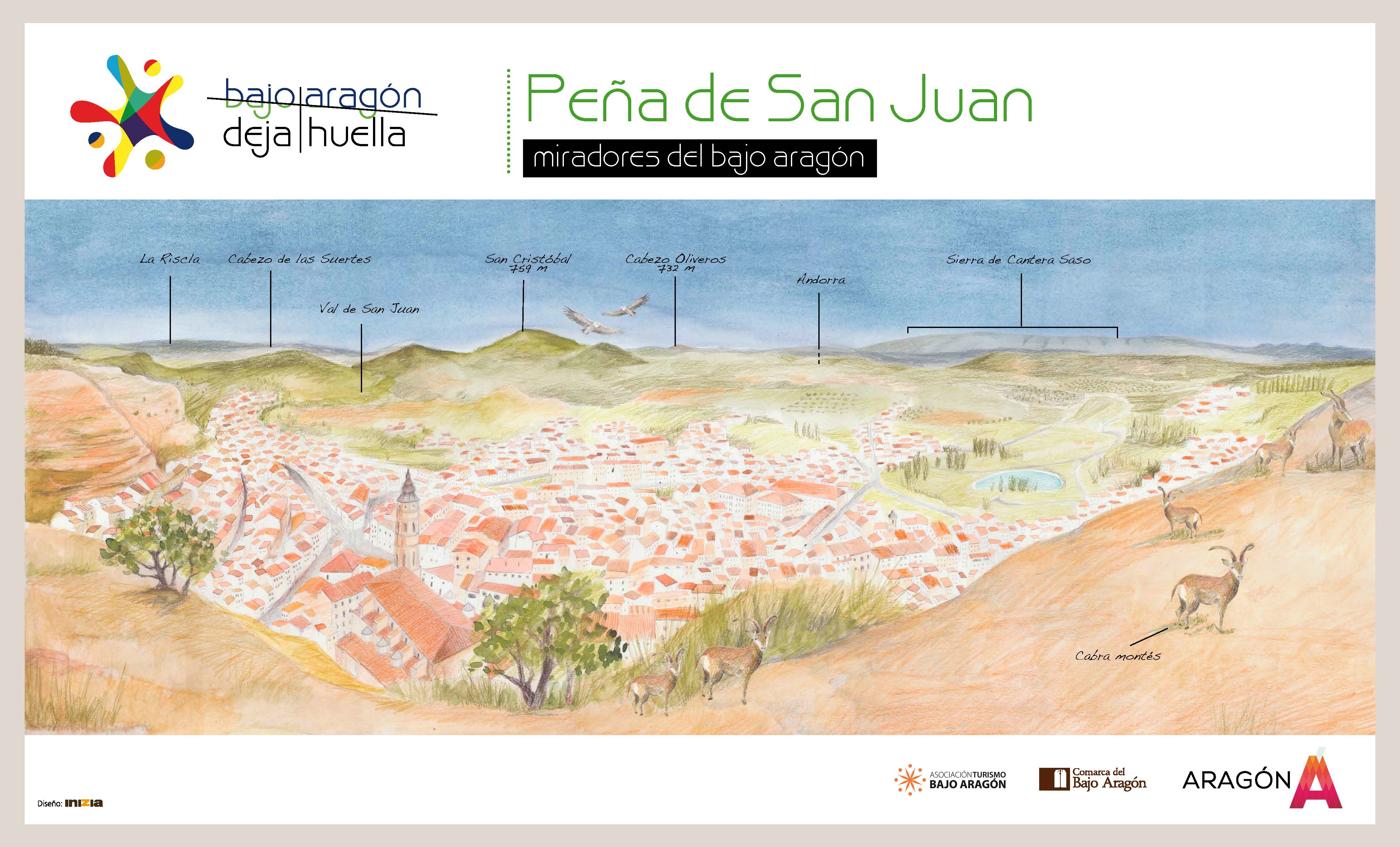
Alcorisa. Peña de San Juan
Foz Calanda. Mirador del Monte Tolocha.
La Ginebrosa. Mirador de las Eras Altas.
La Mata de los Olmos.
The special protection for the birds (ZEPAs) was a marvellous way of understanding the conservation of the nature, because the birds are a group very sensitive to the human actions. Later, the LICs (Places of community interest) were added to them : spaces respected by the man where agricultural activity has shaped diverse and beautiful landscapes filled with animals and plants which depend on this traditional activities to survive. The decline of these former and traditional uses of the man makes that the persistence of some plants and animals will be in danger
In “Bajo Aragon” you can find ZEPAs and LICs like: “saladas” of Alcañiz and Calanda ( a small and salty pond) , the river basin of The Guadalope, the Bergantes and the Mezquin. Two different kinds of areas related to the river Ebro and to the Iberian Mountain Range.
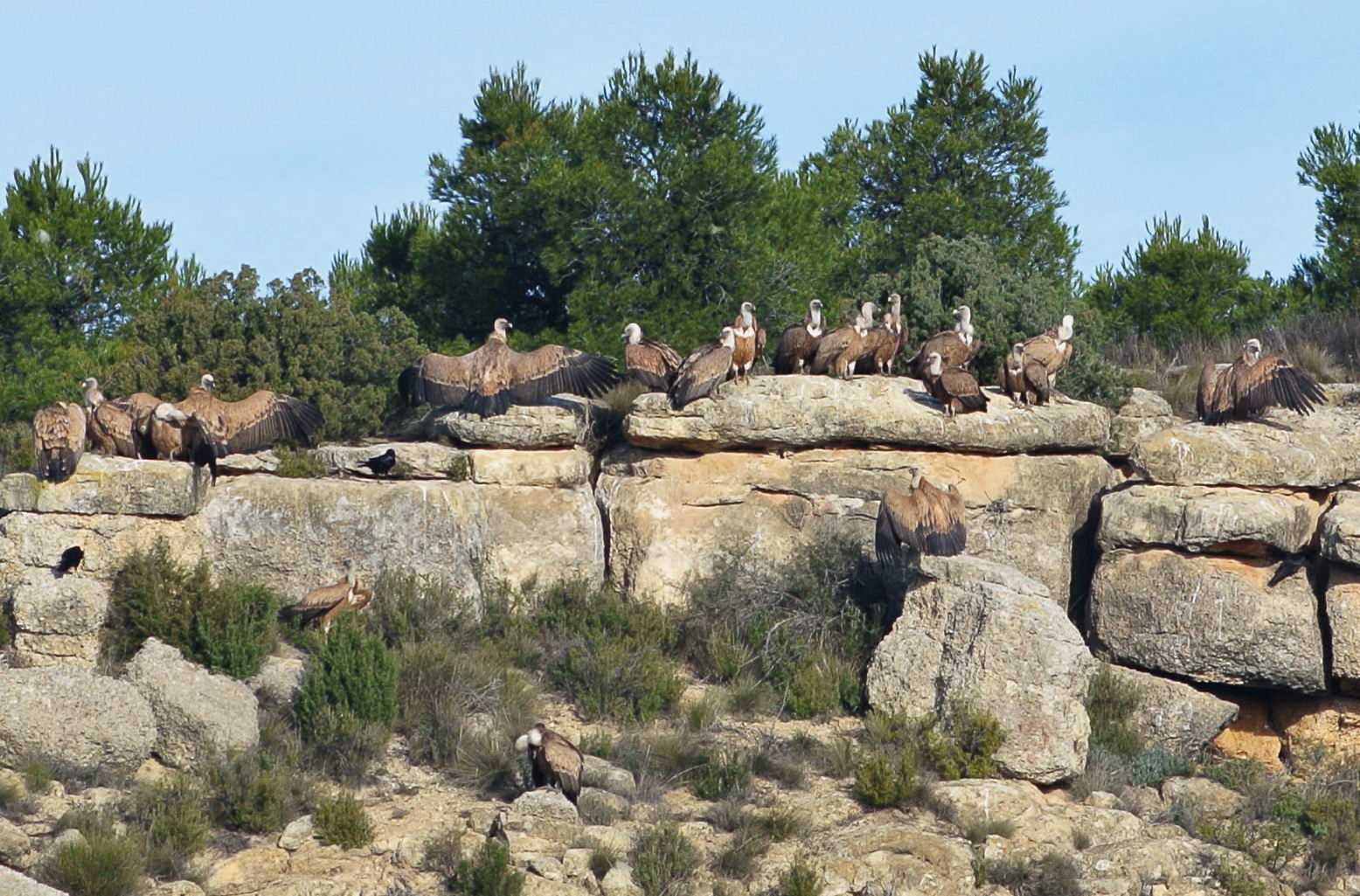
Among the issues raised by the BSE – ‘mad cow disease’ – crisis in its day was the creation of scavenger bird feeding stations that would allow food to be made available to scavenger birds, which were suffering from a reduction in their usual food source, as farmers were no longer permitted to leave their dead animals in the open owing to health risks. This led to what would become the Aragonese Network of Scavenger Bird Feeding Stations (RACAN), a network that is spread throughout Aragon, two of which are found in the Lower Aragon region. There are scavenger bird feeding stations in the municipality of La Mata de los Olmos and in the municipality of Alcañiz.
Scavenger bird feeding station route
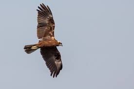
There are two feeding stations for scavenger birds in the regions, one in Alcañiz and the other in La Mata de los Olmos. Both are stocked with whole animal carcasses received from farms, and with waste from abattoirs. This makes them appealing both for vultures, which prefer whole carcasses, and other birds such as the black and red varieties of kite, and corvine species such as jackdaws, crows and magpies.
Download information from the guide Aves y Territorio. Un recorrido ornitológico por el Bajo Aragón (Birds and Region. A birdwatching visit to the Lower Aragon region).
A panoramic view is an attractive way of coming to know and enjoy a place.
By continuing with its work to create the Route of the Vantage Points, the Lower Aragon regional administration has, in recent weeks, fitted panoramic explanatory panels for interpreting the landscape at the Castle of the Knights of Calatrava in Alcañiz and the chapel of Santa Bárbara in La Codoñera, which complement those already existing vantage points in the towns of Belmonte de San José, Castelserás, La Ginebrosa, Torrevelilla and Valdealgorfa. These vantage points, together with those set up by the Cultural Park of the Maestrazgo in the towns of Aguaviva, Alcorisa and La Cañade de Verich, allow magnificent views of this land to be enjoyed from different natural lookouts. In the region, such diverse areas such as semi-arid steppes, Mediterranean forests and so-called premontane ecosystems can be identified.
The network of vantage points is earmarked for expansion with the incorporation of new viewpoints from which to enjoy this region.
This project is being undertaken through collaboration by the Bajo Aragón-Matarraña Local Action Group, which is partly financing its cost.
VANTAGE POINTS
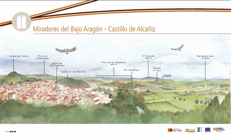
ALCAÑIZ- Castle of the Knights of Calatrava
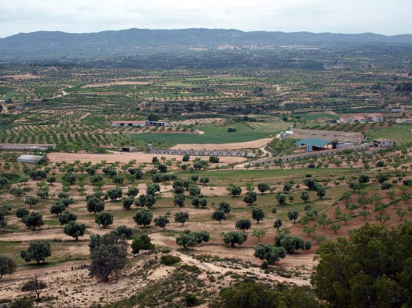
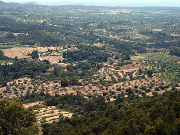
The castle stands on one of the few high hills in this part of the region. The wide plain that is an extension of the Ebro Valley, with its gentle hills and wide open spaces begins to change here, in the valley of the River Guadalope. From this privileged height, we can see how the terrain gradually begins to resemble an area of foothills towards the east, where the Puertos de Beceite Mountains meet the Sierra de La Ginebrosa Mountains, the ridges of which can be appreciated in the distance. Below us we see the River Guadalope, which runs down from the mountains of the Maestrazgo region and partly encircles the lowland at the foot of the hill on which the early settlement of Alcañiz once stood, before it continues along its way to join the Ebro. The striking profile of Mount Tolocha is easy to make out, a natural watchtower located at the heart of the Lower Aragon region. And to the right is El Plano, a broad plain now transformed by irrigation, which extends towards the towns of Calanda, Alcorisa and Andorra. Inside this space are the Saladas, salt lakes that form a unique natural space on the steppe.
From here the presence of different solitary hills, similar to this one, can be made out: Cabezo de San Pascual, Cabezo de Cuervo and Campamento Hill (where there is an old communications tower dating from the Carlist wars), all of them cloaked with young pines resulting from reforestation efforts made in the 1960s. The existence of pre-Roman settlements at the El Palao and Alcañiz la Vieja sites confirm the importance of these hills in Alcañiz.
Texts by Fernando Zorrilla Alcaine
Scenic and Environmental Catalogue Fundación Quílez Llisterri.
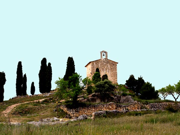
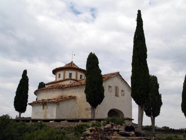
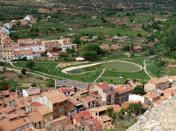
CASTELSERÁS- Chapel of Santa Bárbara
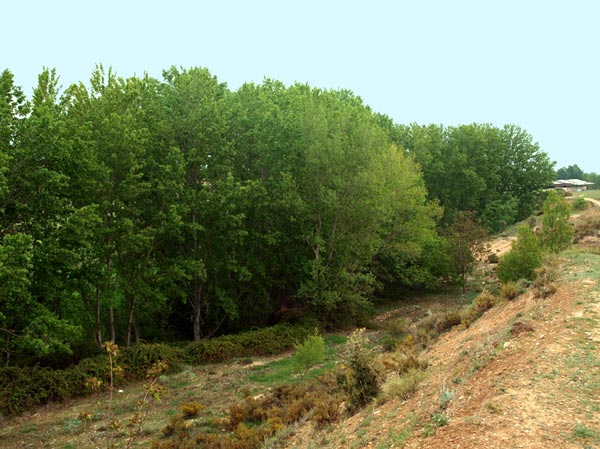
Santa Bárbara Hill and its white chapel stand out in the surroundings of the town of Castelserás. This solitary high place, located between the flat agricultural lands and the sloping wild country is a wooded island where many birds seek refuge. The steep slopes of this place are thickly cloaked in Aleppo pine, with a few specimens of remarkable size and great longevity. There is also the anecdotal presence of a few specimens of Judas tree, planted along the side of the path leading to the chapel and dating from the time that the famous botanist Pardo Sastrón visited this space.
The panoramic view enjoyed from this place helps to understand the lay of the land and the transformation of the landscape in the area and in the surroundings.
Texts by Fernando Zorrilla Alcaine
Scenic and Environmental Catalogue Fundación Quílez Llisterri.
LA CODOÑERA- Chapel of Santa Bárbara
The chapel of Santa Bárbara is located not far from the town, on a spur of the surrounding mountains. Its magnificent situation resembles that of a watchtower from where the nearby countryside can be seen, making it the ideal place for interpreting the landscape of the Lower Aragon region. The surrounding land is covered by an extensive Aleppo pine forest, with a number of centenarian specimens. Access to the chapel has been improved in recent years, making it a pleasant walk.
Close to the chapel is the La Tellería Reservoir, one of the largest sources of water for livestock in the entire area.
Texts by Fernando Zorrilla Alcaine
Scenic and Environmental Catalogue Fundación Quílez Llisterri.
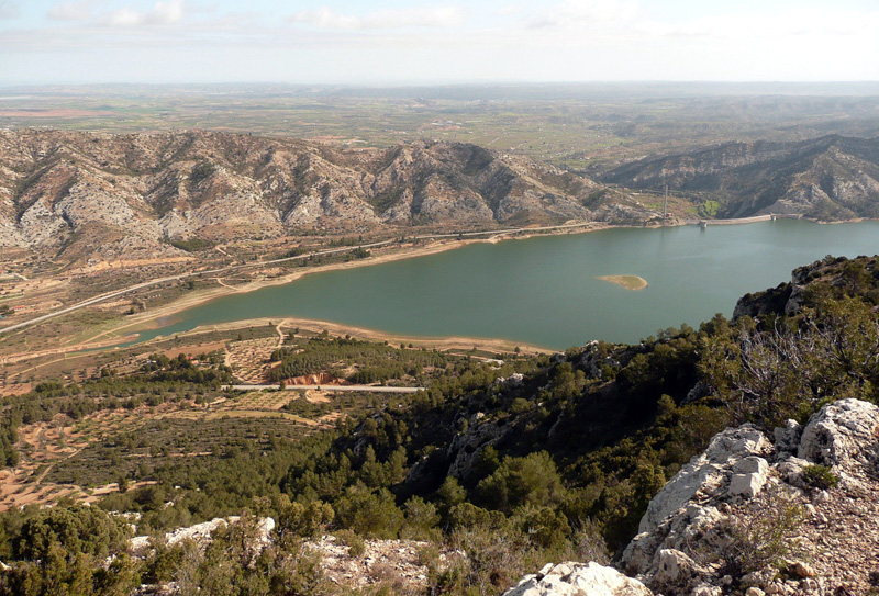
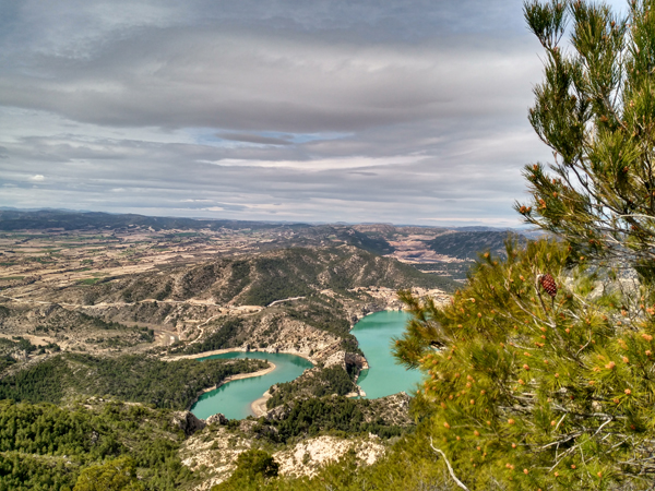
LA GINEBROSA- La Tarayola Vantage Point
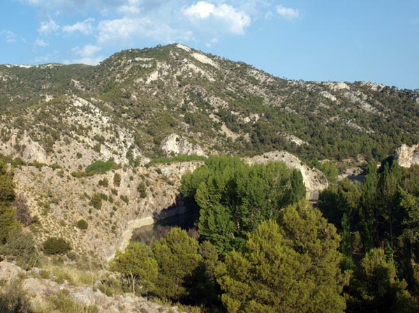
The summit of Mount La Tarayola is an excellent vantage point that looks out over much of the central area of the Lower Aragon region. At an altitude 826 m, it forms part of the Sierra de La Ginebrosa mountains. The mountains themselves belong to the Iberian Mountain Range, and are characterised by their vegetation cover, mainly Aleppo pines, holm oaks and juniper, from which La Ginebrosa takes its name.
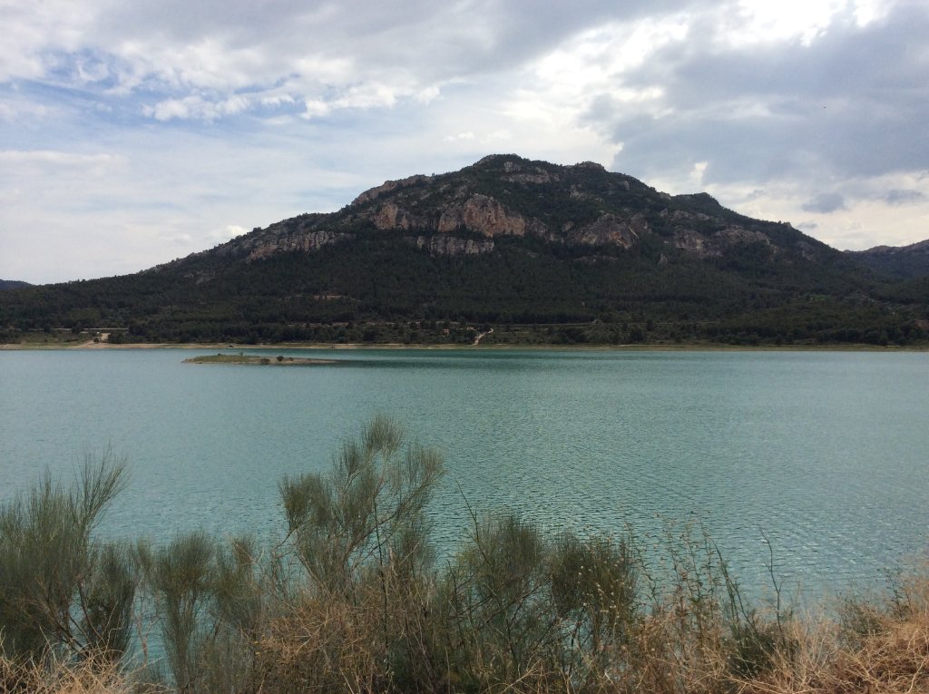
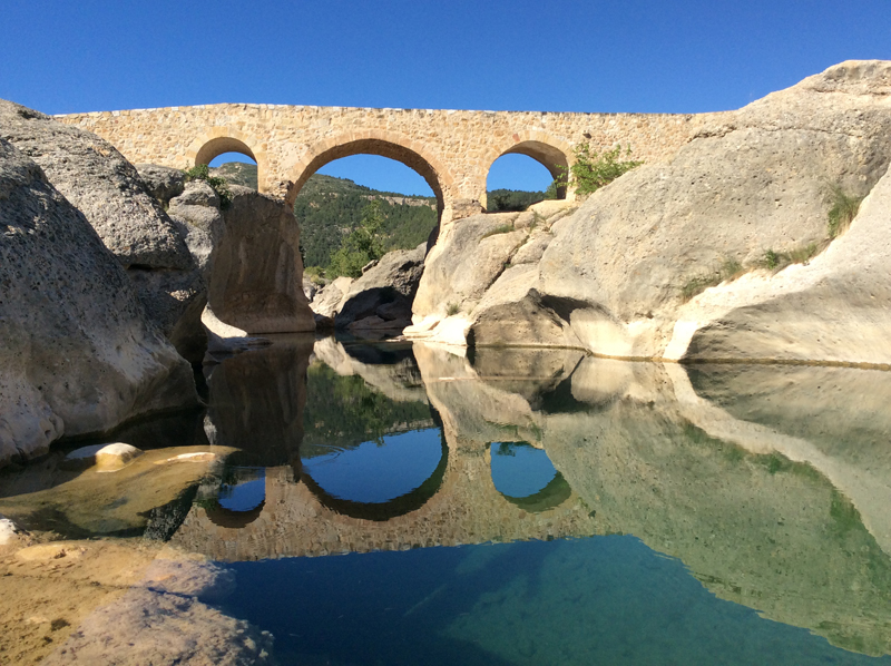
The proximity of this site to other singular places, such as the Pilón de San Marcos, the Desierto de Calanda convent and the Calanda Reservoir give this place a special appeal, particularly on clear days, and a visit is essential for an educational interpretation of the landscape of a large part of the Lower Aragon region.
Texts by Fernando Zorrilla Alcaine
Scenic and Environmental Catalogue Fundación Quílez Llisterri.
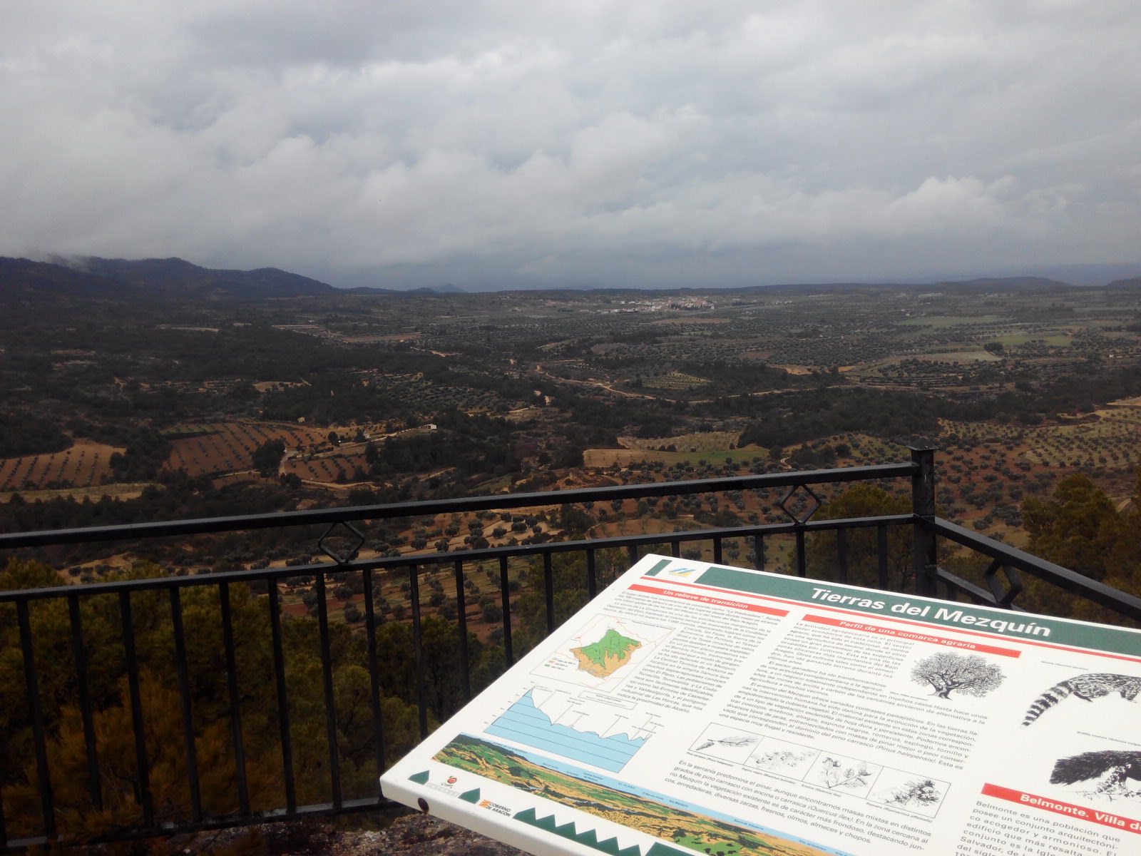
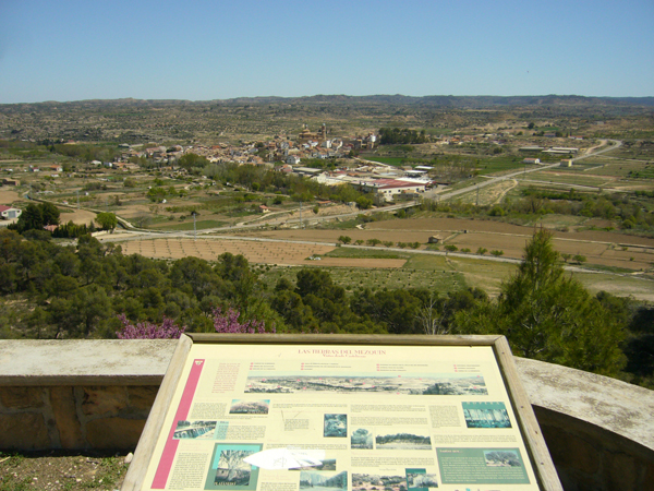
TORREVELILLA- El Pilón Vantage Point
Sierra de la Ginebrosa-Iberian Mountain Range.
The Sierra de La Ginebrosa mountains extend through the municipalities of Torrevelilla, La Ginebrosa, La Cañada de Verich and Calanda. These mountains are easily made out from many places in the Lower Aragon regions. Cloaked in forests, they extend to the nearby Calanda Reservoir. Owing to their orientation, Torrevelilla is in their shade, while the sunnier slopes face La Ginebrosa. The mountains are covered with thick Aleppo pine forests with many specimens of holm oak. Gall oaks can also be found in areas with more moisture.
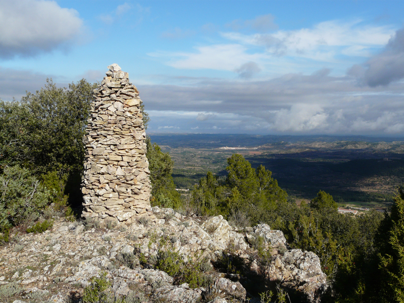
A trail (PR-TE-14) runs along the ridge of these mountains, from where the view and landscape of the Mezquín Valley and much of the Lower Aragon region can be admired. The most suitable place for this is the site known as Pilón de Torrevelilla, in reference to the triangulation pillar located there. A visitor's book hangs from the pillar allowing visitors to express their feelings once they arrive at this place. Don't forget to sign it as proof of your visit to this vantage point.
Texts by Fernando Zorrilla Alcaine
Scenic and Environmental Catalogue Fundación Quílez Llisterri.
VALDEALGORFA- Chapel of Santa Bárbara
This mount (alt. 624 m) is a wooded isle set amidst terraces planted with almond and olive trees, and is very close to the N-232 road. At its highest point is the chapel of Santa Bárbara, a place offering a broad panorama of the historic Lower Aragon region, and the Terra Alta and Los Puertos regions. The chapel is an integral part of the landscape and is easily made out from a great distance. Its proximity to the road and the easy access make it a well-frequented place by tourists and locals alike. Also, the short distance trail PR-TE11 that connects the town of Valdealgorfa with La Codoñera passes close by.
The existing vegetation mainly comprises a thin cover of pine trees and Aleppo pines grow poorly here, although there are large pine specimens in the shady areas, which have served as parent trees in the colonisation of this area by the forest. Other types of vegetation include kermes oak, juniper and rosemary. For many years the Friends of the Chapel Association has taken care of maintaining the place.
This space serves as a refuge for such wildlife species as buzzards and tawny owls, with the rare presence in the surrounding area of red-rump swallow nesting sites.
Texts by Fernando Zorrilla Alcaine
Scenic and Environmental Catalogue Fundación Quílez Llisterri.
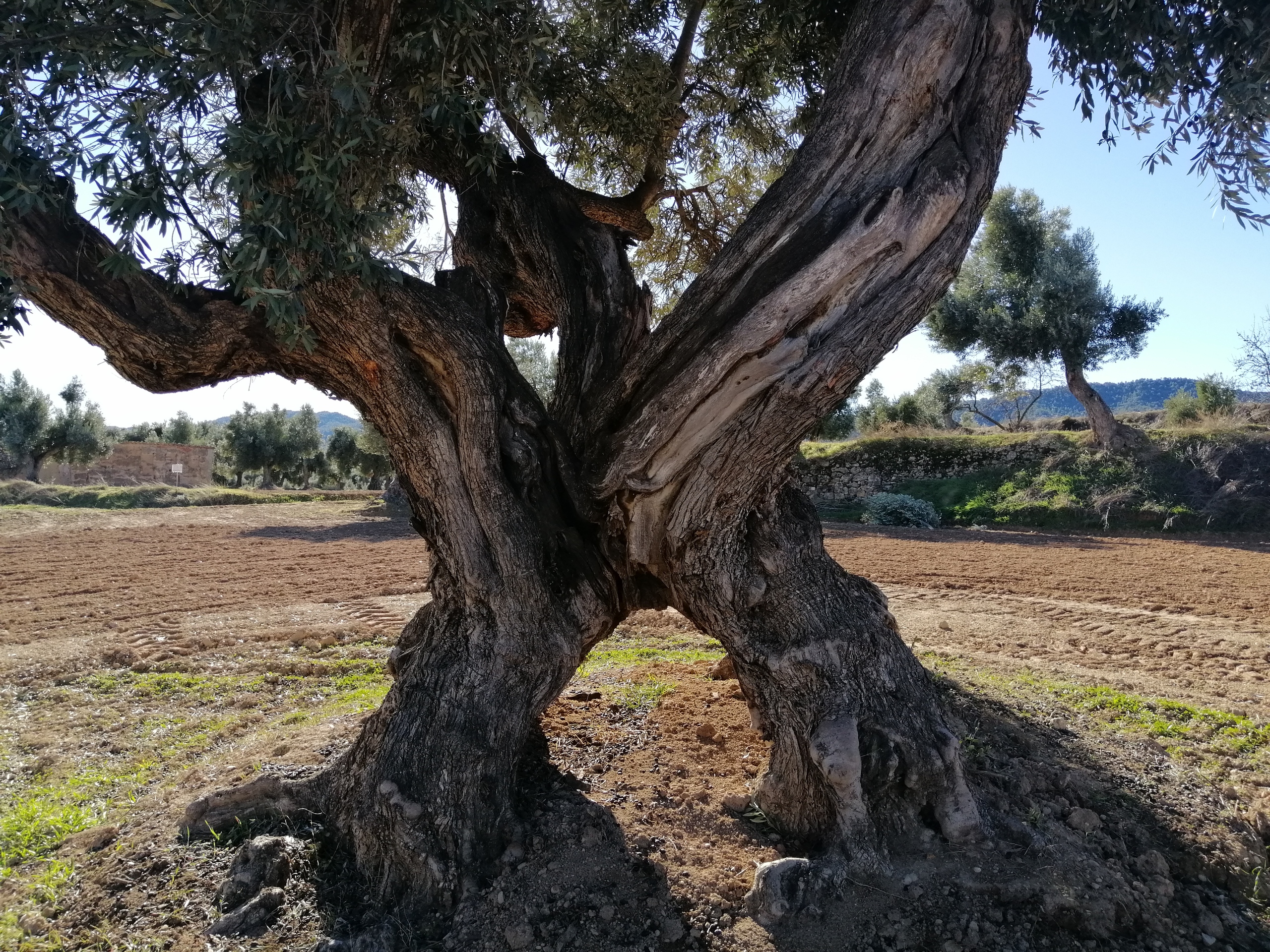 El proyecto Oliveras Centenarias se extiende por varios municipios del Bajo Aragón Histórico. Su finalidad pretende recopilar en un catálogo abierto los ejemplares de Oliveras Centenarias que destacan por sus grandes dimensiones. Un patrimonio histórico, económico, cultural y medioambiental que supone en la actualidad menos del 1% de la superficie que ocupa el olivar en ese territorio.
Para ello, mediante un minucioso trabajo de campo en el que han participado numerosos vecinos, se han localizado varios ejemplares que superan los tres metros de perímetro en el tronco medidos a la altura del pecho. En el caso del Bajo Aragón, se han incluido tres municipios pertenecientes al área del Mezquín, en concreto los términos de La Codoñera, Belmonte de San josé y Torrevelilla. De las Oliveras catalogadas, se han señalizado varios ejemplares asociándolos a varias rutas o paseos que permiten conocerlas más de cerca. Esto ha sido posible gracias a la colaboración de los propietarios, que han permitido su ac
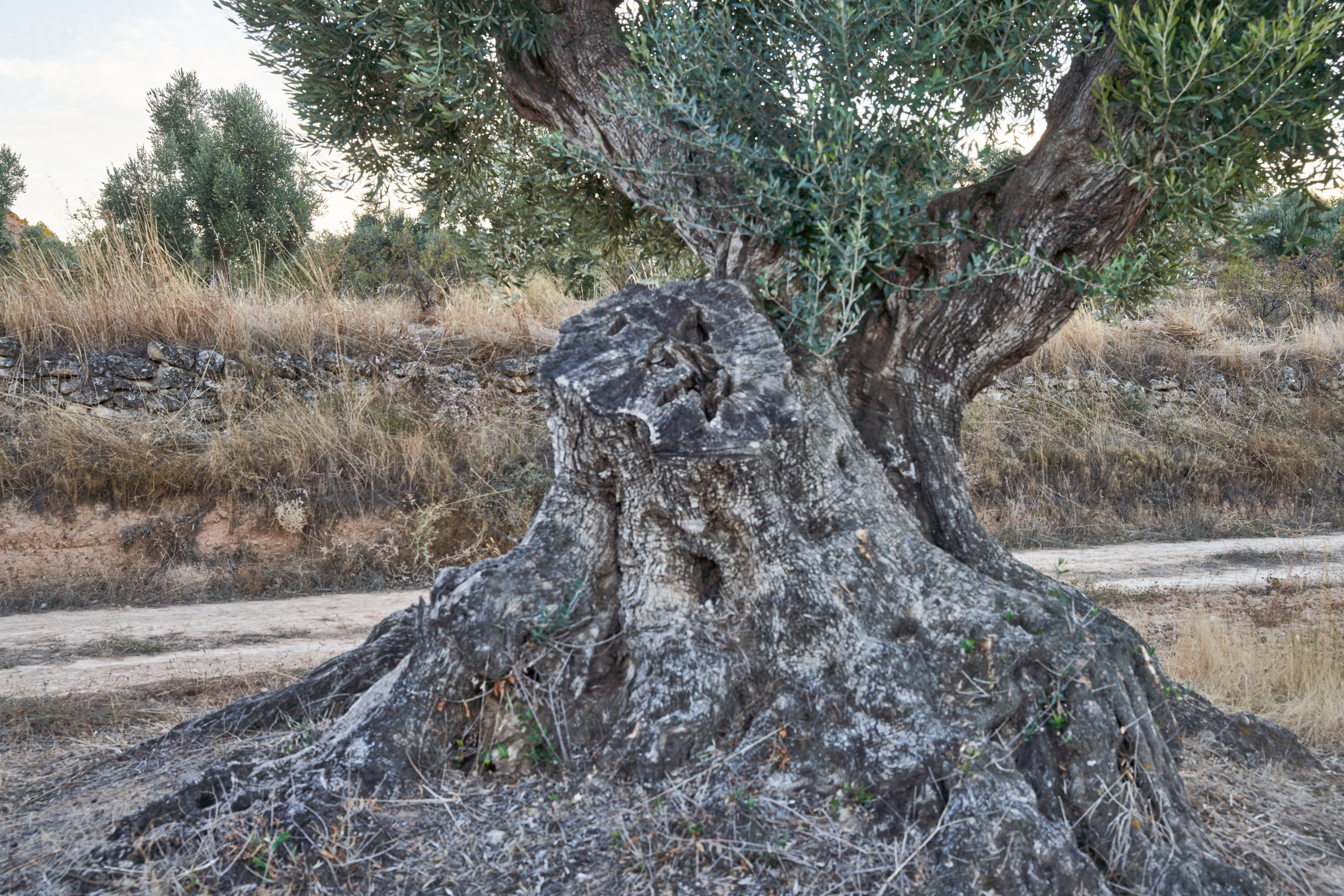
ceso y difusión.
Y es que a lo largo de las últimas décadas han ido desapareciendo grandes ejemplares de Oliveras. La histórica helada del año 1956, que se alargó prácticamente durante todo el mes de febrero, y que llegó a alcanzar hasta los 14º bajo cero, supuso un golpe mortal para numerosos ejemplares cuyo destino final fue su corta para leña. Después vendría el arranque de grandes Oliveras mediante potentes máquinas, para sustituirlas por otros cultivos más prometedores como la viña, el almendro o el cereal. Por último, ya más recientemente, la incorporación de maquinaria en forma de grandes tractores y paraguas recolectores han sustituido a lo largo de los últimos años la recogida tradicional. Todo ello ha supuesto la adaptación del árbol a la maquinaria mediante la corta de grandes cimales y el arranque de muchos de ellos para sustituirlos por nuevas plantaciones más operativas y funcionales. Resulta evidente que hoy en día una plantación de jóvenes empeltres resulta más productiva y rentable que esos viejos árboles descolocados por el mercado y el tiempo, pero esos ejemplares son únicos y singulares, algo que el mercado, la administración y especialmente la sociedad también tendrán que valorar tarde o temprano, precisamente por su escasez, planteando medidas de apoyo al árbol y al propietario y/o agricultor que las atiende para facilitar su permanencia en el futuro. Este es uno de los objetivos de este proyecto que en definitiva pretende que las diferentes actuaciones que se realicen en su ámbito redunden en beneficio del árbol y del agricultor que lo trabaja.
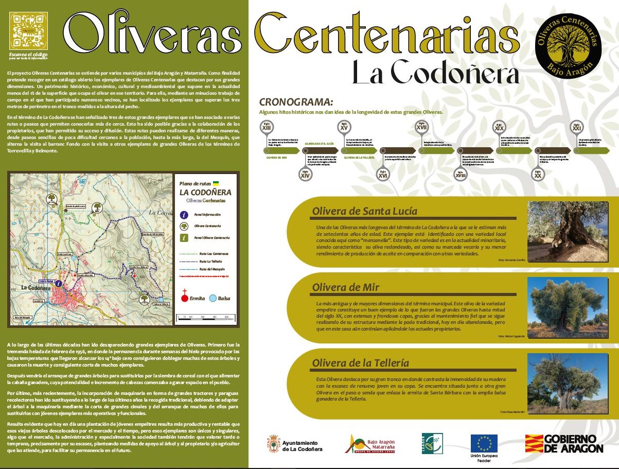
OLIVERAS SELECCIONADAS
TERMINO MUNICIPAL DE LA CODOÑERA
Número de Oliveras catalogadas ….............. 20
Oliveras señalizadas …............... Olivera de Santa Lucía
Olivera de Mir
Olivera de La Tellería
Rutas asociadas
1C. La Ruta de los Canteresos. ( 3,26 kms.)
2C.- De Santa Lucía a la Tellería ( 5,92 kms.)
3C.- Ruta del Mezquín ( 10,48 kms.)
Las rutas propuestas pasan por algunas de las Oliveras señalizadas, siendo posible realizar diferentes combinaciones entre las mismas en función del interés del visitante ya que todas están unidas por tramos. Todas están planteadas para realizarlas a pie.
Ruta 1C.- Ruta sencilla de algo más de tres kilómetros que discurre por una zona cercana a la población sin apenas pendientes y en donde se visitan las Oliveras de Santa Lucía y de Mir.
Ruta 2C.- Ruta que aprovecha gran parte del recorrido de la anterior hasta llegar al camino viejo de Valdealgorfa a Codoñera, en donde gira y se dirige por la val de Balat hacia la ermita de Santa Bárbara. Se visita la Olivera de la Tellería. Recorrido de fuerte pendiente en el ascenso a la ermita.
Ruta 3C. Ruta que parte de la localidad con la posibilidad de haber realizado previamente la ruta 2, y se dirige hacia la población de Torrevelilla atravesando el río Mezquín. Discurre por zona de olivar hasta su llegada al panel informativo de los Mases, en donde cabe la posibilidad de continuar hacia Belmonte, o de llegar hasta Torrevelilla.