


|
SPA |
Municipalitiess | Total surface area | Surface within the region |
| Río Guadalope - Maestrazgo |
Aguaviva, Las Parras de Castellote, Mas de las Matas and Seno |
54.244 ha | 3.260,64 ha |
Habitats or species of interest:
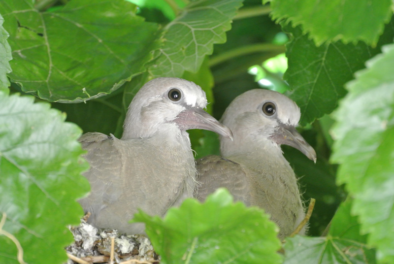
Egyptian vulture (Neoprhon percnopterus) peregrine falcon (Falco peregrinus) golden eagle (Aquila chrysaetos) Bonelli’s eagle (Aquila fasciata) short-toed snake eagle (Circaetus gallicus) booted eagle (Hieraaetus pennatus) red-billed chough (Phyrrhocorax phyrhocorax)
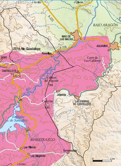
Around the Guadalope - Maestrazgo SPA
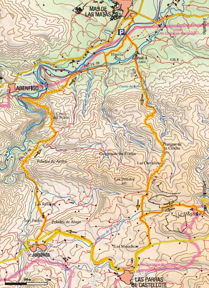
The Guadalope - Maestrazgo Special Protection Area extends more than 55,000 hectares along the River Guadalope and its upper tributaries, most of which is found in the Maestrazgo region of Aragon. However, some 3,000 hectares lie within the Lower Aragon region, mainly in the municipalities of Aguaviva and Las Parras de Castellote. This route partly follows scenic trail PR-TE 50.
Download information from the guide Aves y Territorio. Un recorrido ornitológico por el Bajo Aragón (Birds and Region. A birdwatching visit to the Lower Aragon region).
| SCI | Municipalities | Total Surface Area |
Surface within the region |
| Río Mezquín y Oscuros |
Belmonte de San José, Castelserás, La Codoñera, Torrecilla de Alcañiz and Torrevelilla |
454 ha | 454 ha |
Habitats or species of interest:
Featuring specimens of ash trees in the immediate vicinity of the River Mezquín, and tuff formations at certain points. Vulnerable wildlife species such as the Egyptian vulture and other forest-dwelling birds of prey can be found here.
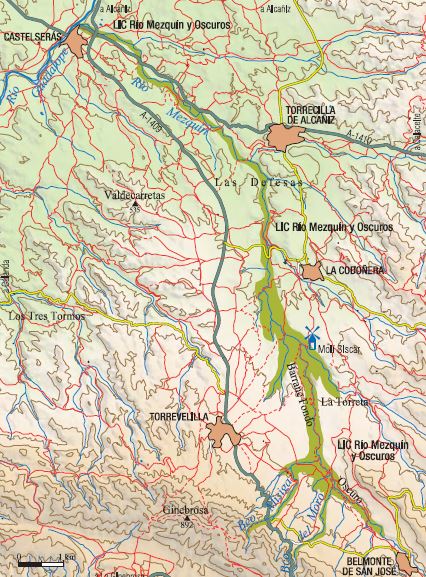
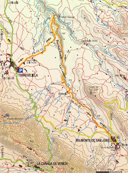
Barranc Fondo Route
A walk along the Barranc Fondo ravine follows the River Mezquín as it cuts through wide expanses of farmland. Although the visit to this natural space can be started at different points, we have chosen a stretch starting in Torrevelilla that takes you to the neighbouring village of Belmonte de San José. It coincides with the route of the scenic trail PR-TE 13.
Download information from the guide Aves y Territorio. Un recorrido ornitológico por el Bajo Aragón (Birds and Region. A birdwatching visit to the Lower Aragon region).
| SCI | Municipalities | Total Surface Area |
Surface within the region |
| Sierra del Vizcuerno | Caspe and Alcañiz | 2.541 ha | 1.256 ha |
Habitats or species of interest:
Featuring plants of interest, such as Boleum asperum, and striking geological formations such as palaeo-channels. This area is also a feeding ground for the Bonelli’s eagle and other birds of prey, such as the golden eagle, northern goshawk, Eurasian sparrowhawk and booted eagle, among others.
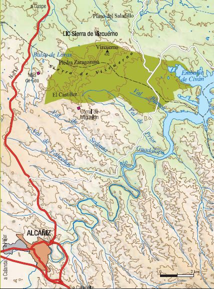
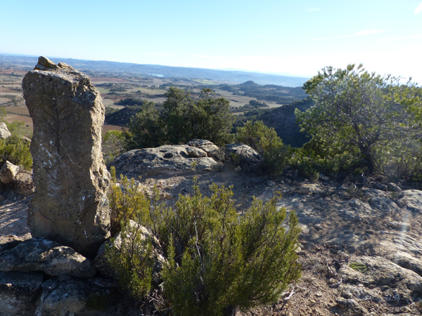
Sierra del Vizcuerno Route: the cairn trail.

This route takes you to the highlands of the Sierra del Vizcuerno, from where you can make out the Ebro Valley as it cuts through Aragon, where the beauty and contrasts of the open lands are intertwined with the harsh reality of a land punished by extreme climatic conditions. In this space, however, you can find unique bird species that have adapted to the conditions of their habitat.
Download information from the guide Aves y Territorio. Un recorrido ornitológico por el Bajo Aragón (Birds and Region. A birdwatching visit to the Lower Aragon region).
| SCI | Municipalities | Total Surface Area | Surfache within the region |
| Saladas de Alcañiz | Alcañiz | 651 ha | 651 ha |
| Saladas de Calanda | Calanda | 33 ha | 33 ha |
Habitats or species of interest:
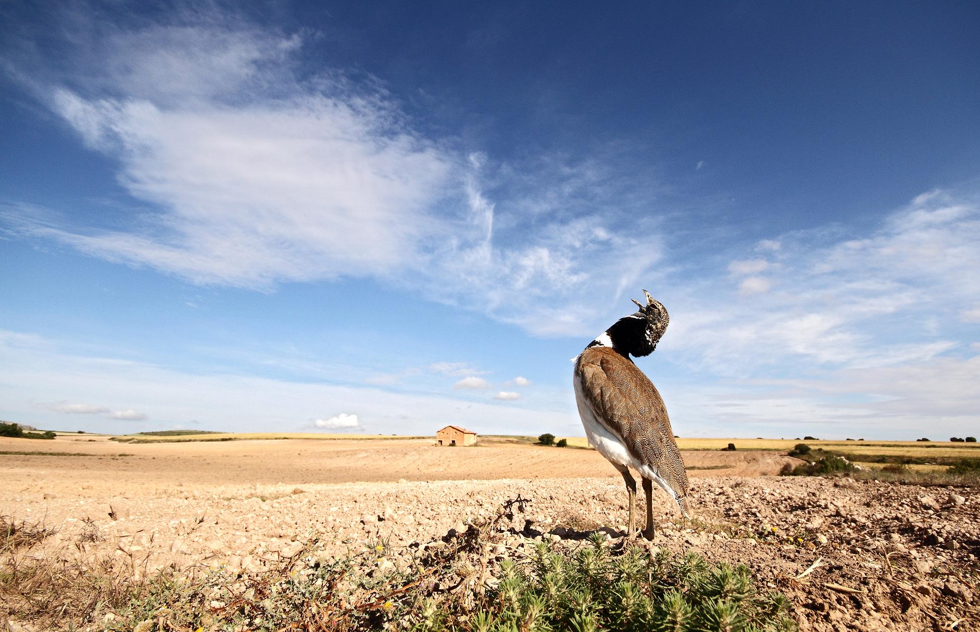
Endorheic salt lakes of great importance in Spain, where diverse endemic species of plants, such as Halopeplis amplexicaulis and Microcnemun coralloides, and different species of wildlife typical of semi-arid areas can be found.

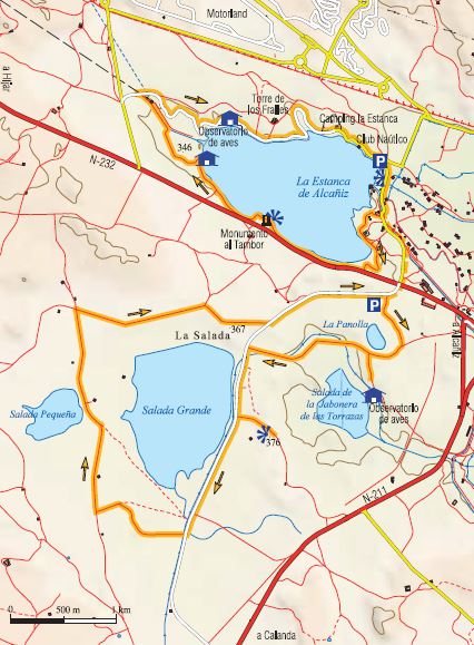
Visit to the Estanca de Alcañiz and Saladas de Alcañiz
This complex of endorheic salt lakes is considered one of the most important on the Iberian Peninsula, although today it coexists with an area of irrigated farmland created in recent years through public programmes for new irrigation works. This has led to the development of new environments and crops associated with irrigation, and a reduction in the dry land area, with only 650 ha remaining, surrounded by newly-created irrigated farmland.
Despite this, the area covered by the SCI still offers a satisfactory wildlife experience, including the opportunity to view birds typical of salt pans and semi-arid areas.
Download information from the guide Aves y Territorio. Un recorrido ornitológico por el Bajo Aragón (Birds and Region. A birdwatching visit to the Lower Aragon region).
| SCI | Municipalities | Total Surface Area | Surface within the region |
| Río Bergantes |
Aguaviva and La Ginebrosa |
241 ha | 241 ha |
Habitats or species of interest:
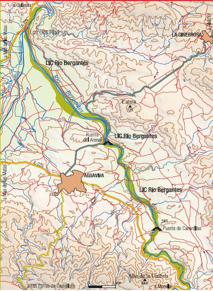
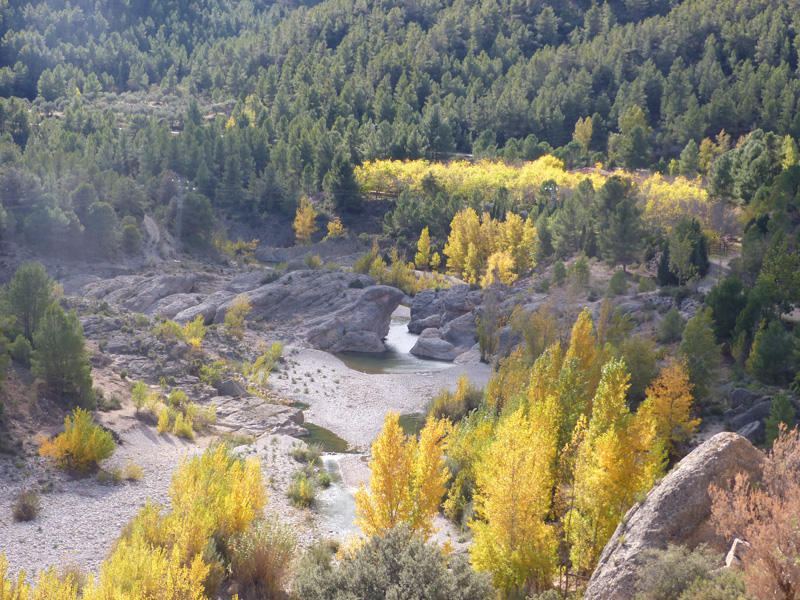
Featuring vulnerable species of animals (otter) and plants (Petrocoptis pardoi). The area close to the Guadalope-Maestrazgo Special Protection Area (SPA) is of great interest for birdlife. Aguaviva and La Ginebrosa are found inside the limits of the Maestrazgo Cultural Park (UNESCO World Heritage site), which is home to different geological formations that are representative of the evolution of the Iberian Mountain Range since the beginnings of the Mesozoic Era. The landscape of Las Cananillas, on the River Bergantes, has been declared a Site of Community Interest (SCI).
Download information from the guide Aves y Territorio. Un recorrido ornitológico por el Bajo Aragón (Birds and Region. A birdwatching visit to the Lower Aragon region).